2013 – Iceland and the Faroe Islands
Date of tour: July 2013 (4 weeks – 21 days in Iceland, 6 days in the Faroes)
Distance travelled: 3700km (within Iceland and the Faroe Islands)
Total cost of tour for two people and two motorbikes: approx. €4400 (including €1700 for the ferry from Denmark)
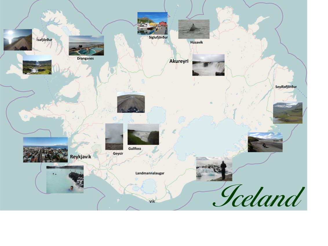
Map of Iceland showing points of interest
Map of the Faroe Islands showing points of interest
Getting there and around
To take your own bikes to Iceland and the Faroe Islands from mainland Europe, the only ferry route in operation at present is that offered by the Faroese company Smyril Line, which sails between Hirtshals (Denmark), the Faroe Islands and Iceland. Watch out for their special summer offers in which motorbikes travel free – we took advantage of this and paid approx. €1700 return for two people and two bikes in private cabin accommodation in 2013.
(Note that the crossing over the North Atlantic can be unpleasant for those not accustomed to sea travel. Take precautions to avoid seasickness, e.g. take travel sickness tablets, eat lightly and stay above deck rather than below.)
Alternatively, you can fly direct to Iceland and rent bikes from Biking Viking, but at rental rates of between €130 and €230 per day, this is a much more expensive option if you wish to tour for longer than just a few days.
The main road around Iceland is Route 1, which is asphalted for most of its 1300km length. The stretches which are not asphalted are composed of hard-pressed gravel and the speed limit is 80 km/h (90 km/h on the asphalted stretches). Some of the longer stretches of Route 1 are straight and flat and can become quite monotonous, especially in bad weather, so if you have the time, it’s preferable to take alternative roads where possible. The “F” roads (e.g. F208) are mountain roads (F = fjall (mountain)) and are little more than loose gravel with fords at river crossings.
Some of the mountain tunnels in Iceland are single lane with passing places. As you enter the tunnel, a sign tells you whether you have right of way or whether you must pull into the passing places in the tunnel to give way to oncoming traffic. Two examples of these tunnels are on Route 60 just south of Ísafjörður and on Route 76 around Siglufjörður.
There are sufficient petrol stations throughout Iceland which are open 7 days a week, although many are self-service and not all debit and credit cards are accepted. The main fuel stations are Orkan/Shell, Olís and N1. Ferry passengers receive a complimentary Orkan discount card, but unfortunately it was these fuel stations that were most problematic in accepting our bank cards. We found the N1 petrol stations most reliable.
6 days on the Faroe Islands
Smyril Line operates two ferries per week from Denmark to the Faroe Islands and one per week to Iceland. This means that you can leave Denmark on Saturday morning, arrive at the Faroe Islands on Sunday evening (at 10.30pm), stay on the Faroes for three days, then catch the ferry to Iceland the following Wednesday evening. If you wish to stop at the Faroe Islands on the return journey, the ferry leaves Iceland on Thursday morning, arriving at the Faroes at 3.00am on Friday morning, where you can stay for three days before catching the ferry to Denmark on Sunday evening.
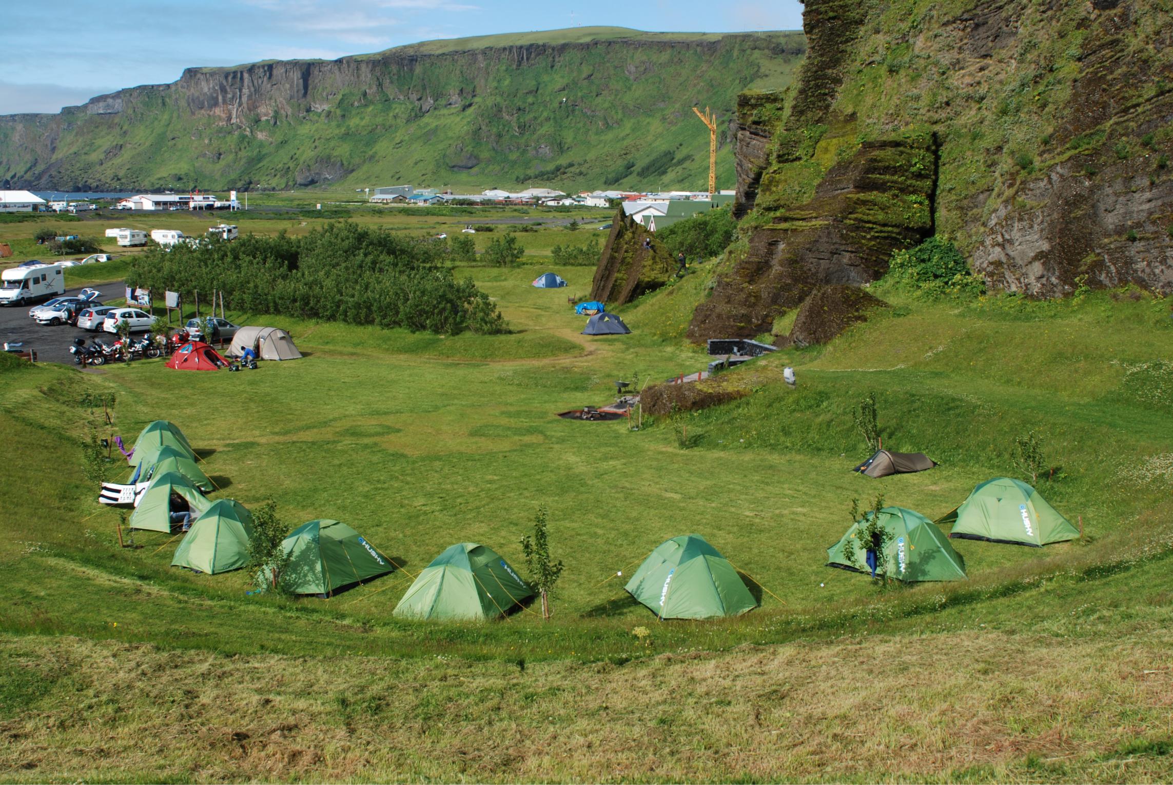
Basing yourself at the campsite in Tórshavn allows you to explore the islands luggage-free via day trips from the capital. The campsite is only a few minutes’ drive from the Tórshavn ferry terminal and is located on the sea front, with views across the fjord to Nolsoy Island. Facilities include a modern and fully equipped kitchen and social area with free wifi and a laundry room. Wild camping is not permitted on the Faroe Islands.
The Faroe Islands consists of the two main islands, Streymoy and Eysturoy, which are connected by a bridge, and a number of smaller islands reachable either by undersea tunnel or ferry. The Streymoy-Esturoy circuit is approximately 250km (more if you wish to include the roads which lead to remote villages and you have to turn back) and makes a good day tour. There is no charge for motorbikes to use the two undersea tunnels to the islands of Vágar in the west and Norðoyar to the north. Sandoy and Suðuroy are at present only reachable by ferry from Tórshavn.
Photos 1–6 are a selection of pictures taken on the Faroe Islands. The photo of Sornfelli (one of the highest mountains in the Faroes at 749m) was taken after riding up the steep single track road from Route 10 about 15km northwest of Tórshavn. Click on the photos to enlarge them.
Our 21-day tour of Iceland
This is a description of our tour day-by-day. Click on the photos on the right to enlarge them.
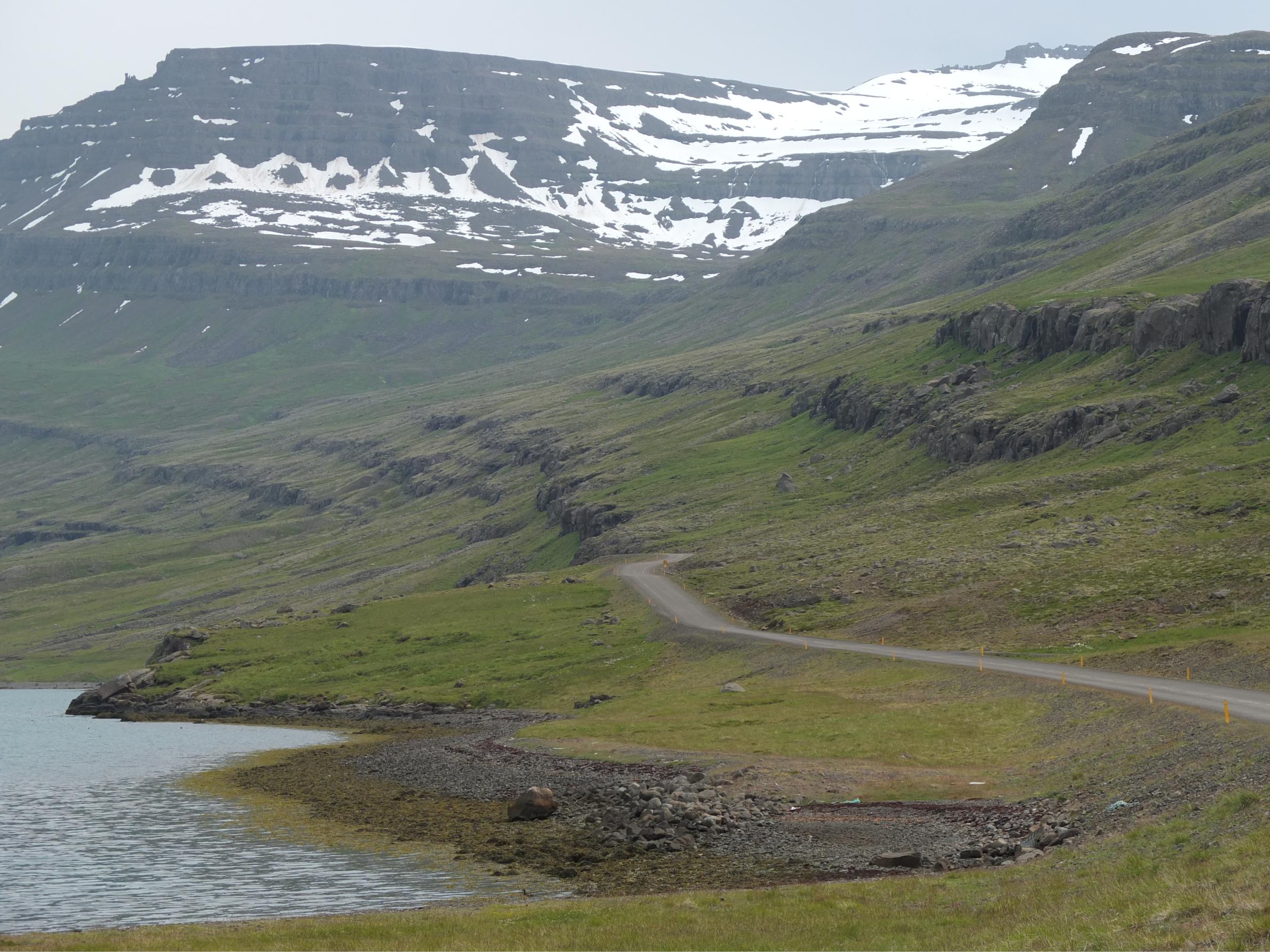
Day 1: From the ferry terminal at Seyðisfjörður (where there is a bank, a fuel station and a supermarket), we headed south to circle the island in a clockwise direction. We followed Rte 93 inland to the larger town of Egilstaðir, then took Rte 92 south. Just past Reyðarfjörður we avoided the tunnel and instead took the coastal Rte 955 and then Rte 96 around the fjords, where we experienced our first gravel roads in Iceland (Photo 7). Our first night was spent at Berunes (see Camping below).
Day 2: We continued on Rte 1 southwards, stopping at the waterfall at Eyjólfestaðir and venturing along the F980 just past Stafafell, but the river was much too full to attempt a crossing (Photo 8). That evening we stocked up on provisions in Höfn and camped at Lambhus campsite, enjoying spectacular views of Fláajökull Glacier (see Photo 9 and Camping below).
Day 3: Continuing southwest on Rte 1, the Jökulsárlón is a must-see (see Photo 10 and Worth a Visit below). A little further on, the Skaftafell Visitor Centre shows an interesting film about the seismic activity that caused the glacier to break up and flood the plains of the Skeiðarársandur in 1996, destroying some of the bridges on Rte 1 on the way. It’s good to watch this film before crossing the plain so you can get an idea of the impact of this natural disaster on the people who lived there. The stretch of Rte 1 between Jökulsárlón and Vík is actually not that exciting, although the changing landscape and vegetation breaks the monotony somewhat. We spent our third and fourth nights at Vik.
Day 4: Basing yourself at Vík for two nights allows you to do one of two options – to take the passenger ferry to the islands of Vestmannaeyjar, or to do the 330km round trip to Landmannalaugar. Since our bikes didn’t have off-road tyres, we chose the island option but we heard from other motorbikers that the Landmannalaugar route, with its 27 river crossings and amazing colours in the landscape, is a must for those wishing to experience some off-road action.
Days 5 & 6: From Vík we headed to the Reykjanes Peninsula in the extreme southwest of the country to have a day at the Blue Lagoon (see Photo 11 and Worth a visit below). The road between Vík and the Reykjanes Peninsular isn’t particularly interesting. We spent our fifth and sixth nights at Grindavík (see Camping below).
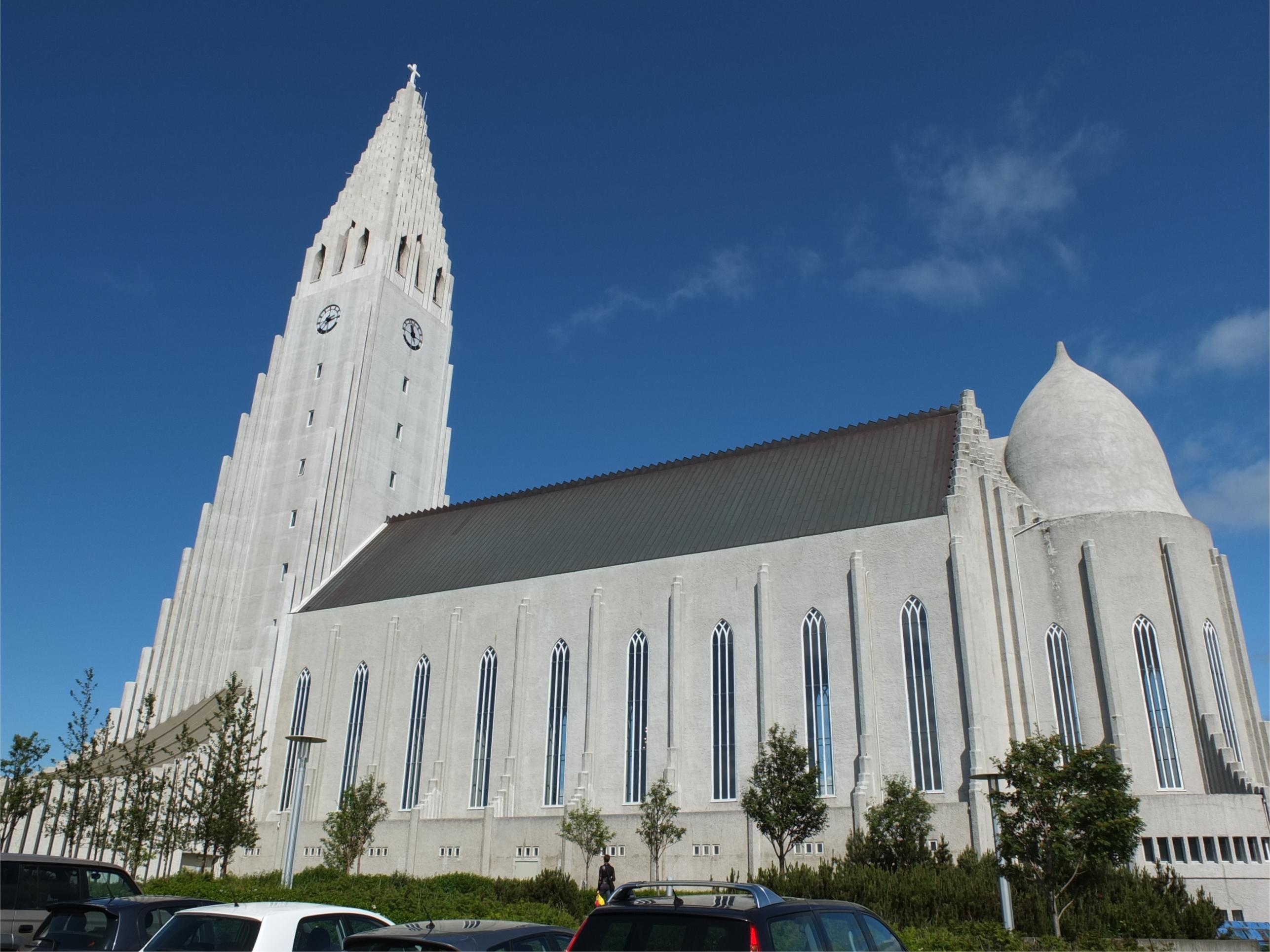
Days 7 & 8: The next two nights were spent in Reykjavík (see Photos 12–13 and Worth a Visit and Camping below).
Day 9: From Reykjavik we headed east to do the “Golden Circle”, the tourist route that includes the Þingvellir National Park, Geysir (Photo 14) and Gullfoss waterfall (Photo 15). That night we camped at Úthlið and relaxed in their hot tub.
Day 10: TOP TIP This was the most challenging day for us as we took the unsurfaced Route 35 (the Kjölur Route) over the mountains to reach the north coast (Photo 16). Of all the roads through the highlands, this one is probably the easiest, since the rivers are bridged. However, most of the stretch north of Hveravellir is composed of loose gravel and when a 4x4 overtakes you, throwing up dust clouds in its wake, then all you can do is keep going and hope for the best. It was a relief to finally reach the hard road at the other end and the campsite at Skagaströnd (see Camping below).
Day 11: We spent the next day and night at Skagaströnd to relax and recuperate in the hot tubs, where we chatted to a very friendly local resident (a common activity in Icelandic hot tubs), who advised us on the best places to visit in the Westfjords.
Day 12: We headed to the Westfjords, as these were a definite must on our Iceland itinerary and we were not disappointed. On the advice of the local resident in Skagaströnd’s hot tub, we camped at Reykhólar, taking Route 60 to get there (see Camping below).
Day 13: TOP TIP – Route 61 This is a fantastic 300km road between Reykhólar and Ísafjörður which winds in and out of the fjords of Ísafjarðardjúp (Photo 17). On this route there is a seal watching point at Hvitanes (Photo 18) and a lovely café at Ögur which serves delicious fish soup.
Day 14: TOP TIP If I had to name the best day of the whole tour, Day 14 would be it. We based ourselves at Ísafjörður for two nights and did a 370km day tour down Rte 60, then circled westwards on Rte 63 to Patreksfjörður and Rte 62 to Flökalundur, where we had a swim and a dip in the hot tub before making the 2-hour journey back to Ísafjörður on Rte 60 (Photos 19 & 20). The road climbs quite high over the mountains, giving fabulous views over the fjords. Much of Rte 60 is hard-pressed gravel and is no problem for bikes without off-road tyres. The section of gravel road on Rte 63 between Rte 60 and Bíldudalur was loose and muddy in places, but it was on this road that we had some of the best views. Rte 60 also contains the oft-photographed Dynjandi waterfall (Photo 21). Unfortunately we didn’t have time to visit Látrabjarg, which so many people had recommended, so that’s on our itinerary for our next Iceland trip.
Day 15: We needed to start heading eastwards again, as we were now entering our third week, so we re-traced our route along the 61 (stopping again at the café at Ögur on the way). Just before Holmavík, we took a slight detour to Drangsnes, simply to experience the free fjord-side hot tubs (Photo 22).
Day 16: We decided to cover a lot of kilometres on this day so that we could spend more time in Northeast Iceland, so we did 380km from Drangsnes to Siglufjörður (Photo 23). The stretch of Route 76 around the Siglufjörður peninsula is interesting (Photo 24).
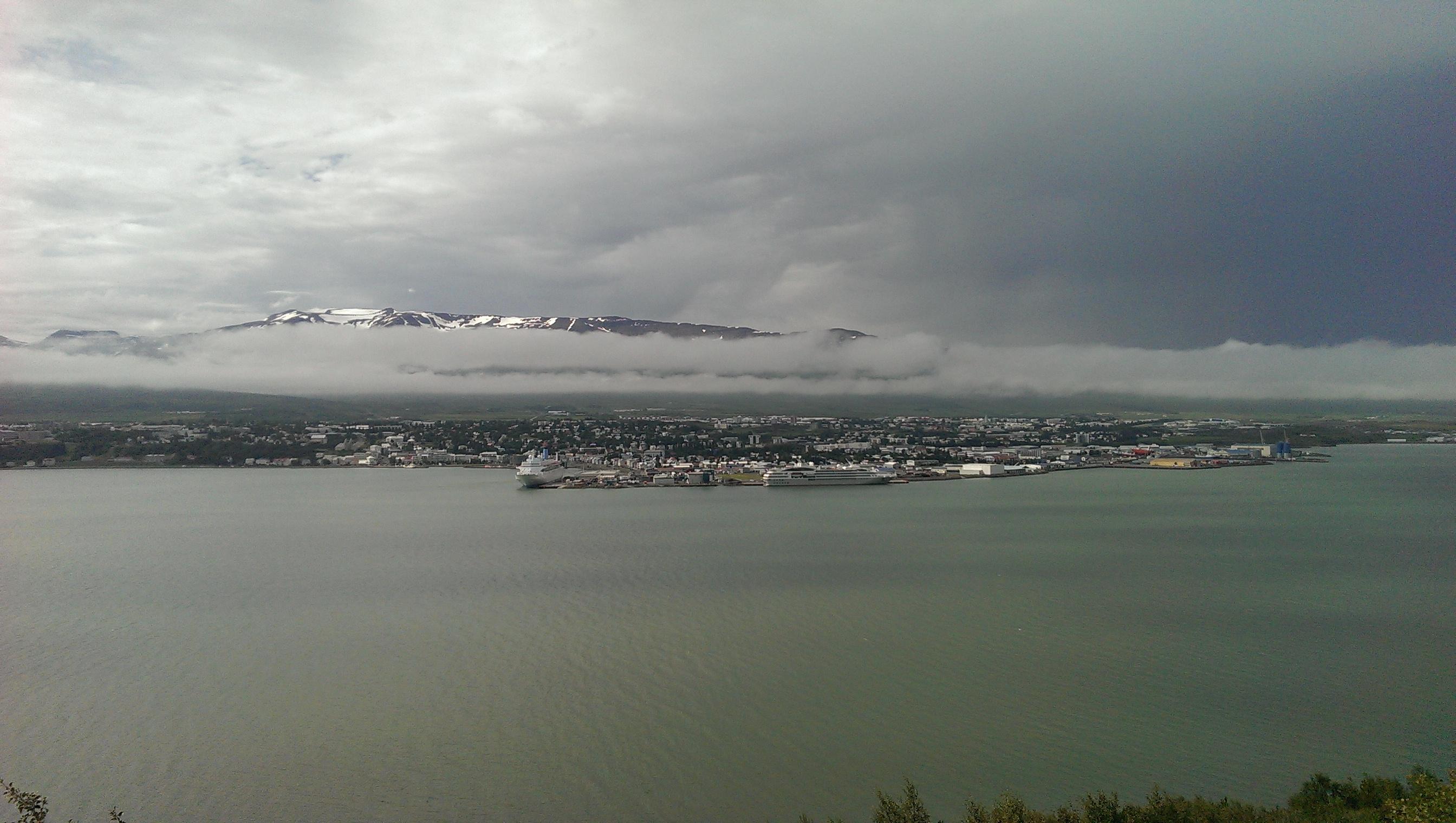
Day 17: We drove 80km down to Akureyri and spent the afternoon and evening exploring Iceland’s second largest town (see Photo 25 and Worth a visit below).
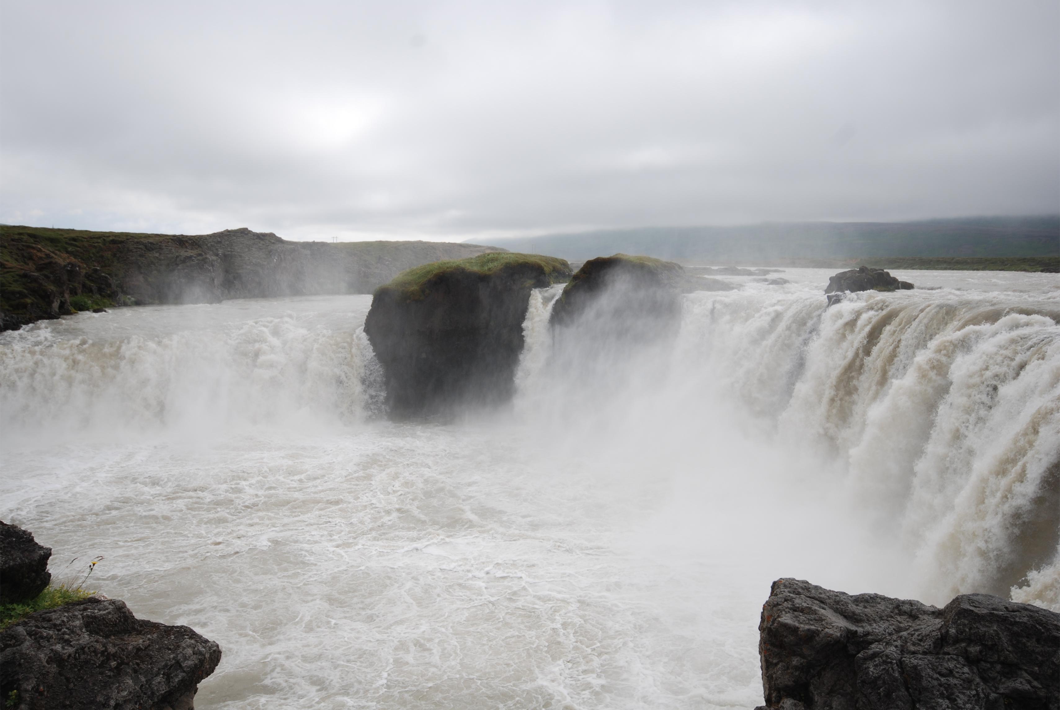
Day 18: Since whale-watching in Húsavík was also on our itinerary, we made our way the 100km up to this harbour town, taking in Goðafoss waterfall on the way (Photo 26).
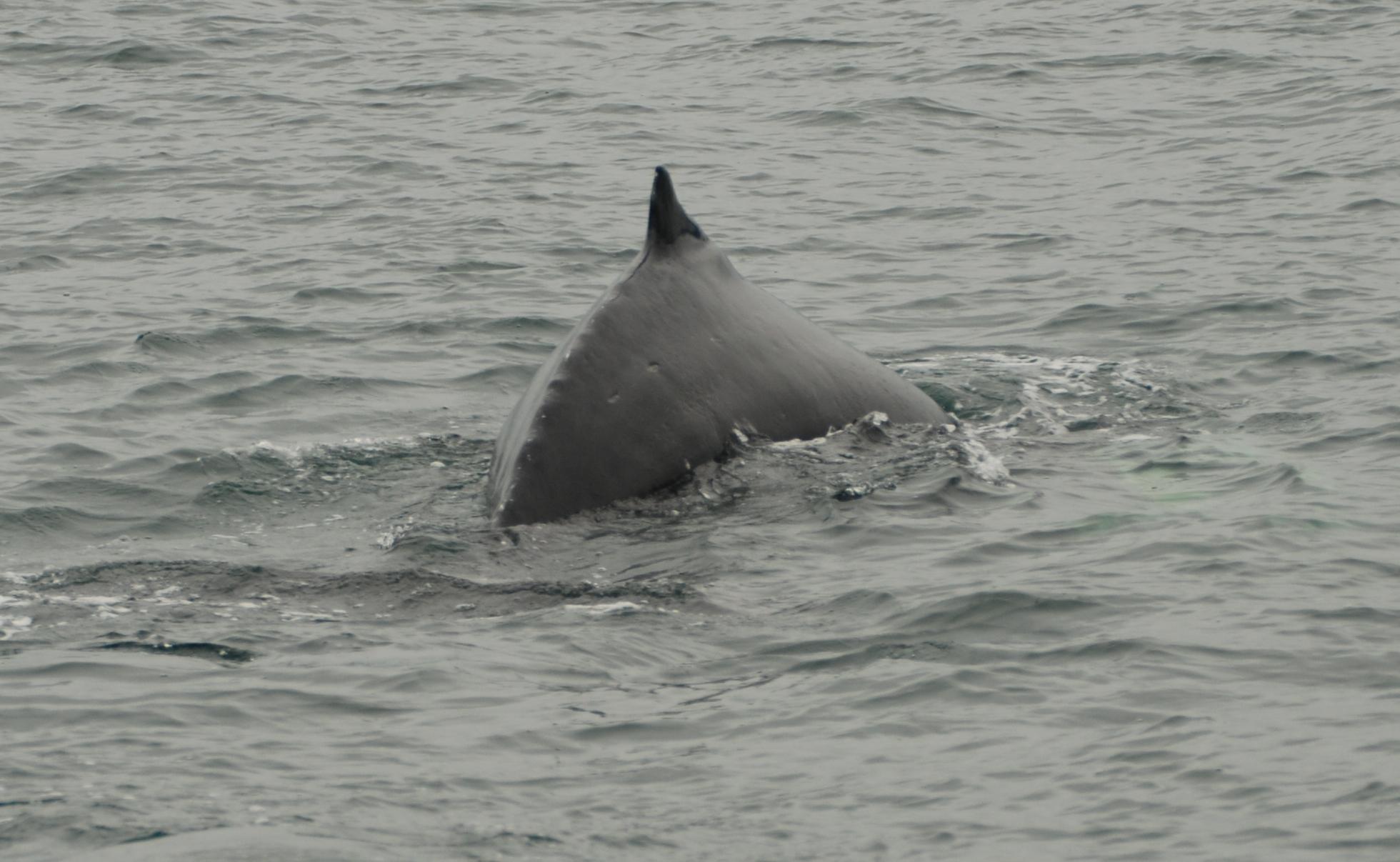
Day 19: We did a whale-watching trip in Skálfandi Bay, which, due to its nutrient-rich waters, attracts up to eleven different species of whales, so spotting one is almost guaranteed. We managed to see humpback whales (Photo 27), minke whales and dolphins and we spent a second night in Húsavík.
Day 20: We made the short (60km) trip to the popular Mývatn (“Mosquito Lake”). The lake is circled by a 36km surfaced road, there is a hot pool (the “Blue Lagoon of the North”) located nearby and around the lake there are ample campsites, cafés and restaurants, particularly on the northeast side.
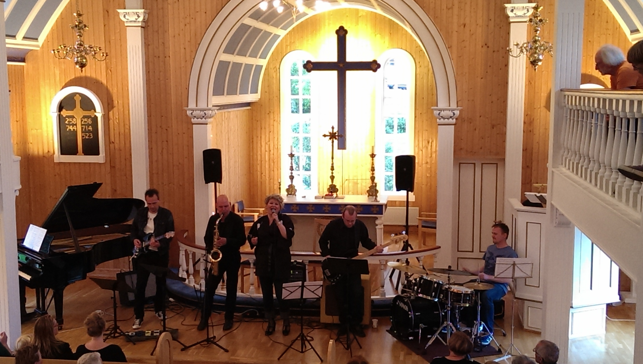
Day 21: Our final day in Iceland was spent travelling the 200km over the hills from Mývatn to the ferry port of Seyðisfjörður. Note that the campsite at Seyðisfjörður fills up quickly with fellow ferry passengers, all waiting for the weekly Thursday morning ferry. A nice way to end your Iceland trip is to go to one of the concerts that are held in Seyðisfjörður church on Wednesday evenings in the summer at 8.30pm (Photo 28).
Camping in Iceland
In Iceland, the Camping Card offers great value. For €99, two adults (and up to 4 children) can stay at 46 campsites located throughout Iceland. The campsites have variable standards; some have no showers or hot running water, others have excellent amenities, including hot tubs (heated from nearby hot springs). Most of the campsites that we stayed at had no wifi.
The Camping Card can be bought online prior to travelling to the country, on the Smyril Line ferry or on arrival at campsites, fuel stations, post offices or some tourist information offices. In any case, camping in Iceland is not expensive – for campsites that do not belong to this scheme, the fees are around €6–7 per person per night and €9 at Reykjavik City Campsite. Wild camping is allowed in Iceland.
The following are some of the campsites we stayed at:
Berunes Campsite is in a picturesque location on Berufjörður. The campsite is quite basic but it does have a shower and kitchen area with hot water, and there is also a hostel with bar/restaurant and free wifi at the site (Photo 29).
Lambhus is a very basic campsite on Lambleiksstaðir farm, which is in a superb location at the foot of Fláajökull Glacier (Photo 9). Showers cost an extra €2.
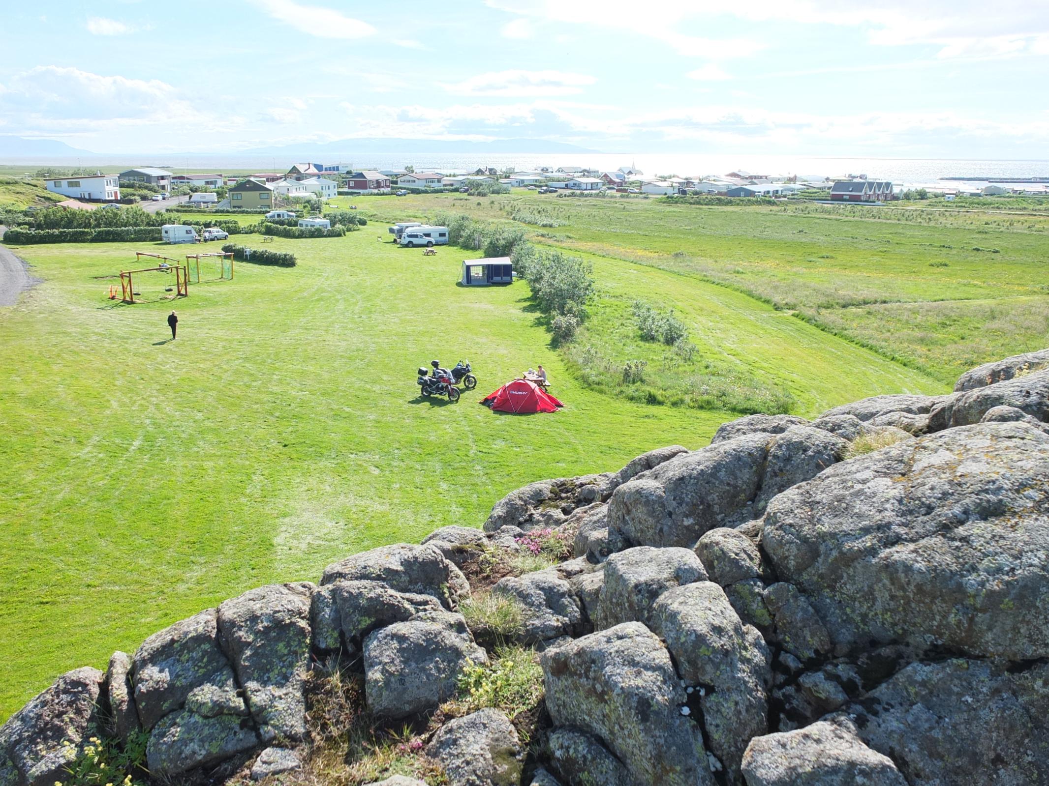
The campsite at Vík is near the centre of this small town. It has hot water, one shower and a kitchen and seems to be popular with overseas school groups (Photo 30).
Grindavík Campsite, located just 5km from the Blue Lagoon, is one of the best of the Camping Card sites. The modern shower block has underfloor heating and there is a large, warm kitchen and dining room (which closes at 10.00pm).
Reykjavík City Campsite is an unattractive place full of international backpackers but it is the nearest campsite to the city centre and is right next to the swimming pool. There is a bus stop right outside the campsite. Alternatively, the 3km walk into the city takes around 45 minutes.
Skagaströnd campsite is in a pleasant location and it has a modern toilet and kitchen block (Photo 31). There are no showers on the campsite but the village swimming pool has hot tubs and showers. In the evening you can have a drink at Kantrybær, Iceland’s only Country and Western bar!
Reykhólar campsite has a beautiful location on Breiðafjörður and is right next to the swimming pool and hot tubs, which are open until 10.00pm (Photo 32).
Tungudalur campsite, around 4km south of Ísafjörður, is situated next to Tungudalur waterfall and river. It has modern toilet and shower facilities and a warm kitchen and dining room.
The campsite in Siglufjörður is simply a patch of grass and a toilet block right in the middle of town, next to the harbour – a perfect location for grabbing something to eat at one of the cafés or restaurants in the evening and breakfast at the local bakery in the morning (Photo 23).
We stayed at the centrally-located campsite in Akureyri but ate at the Backpackers Hostel, where we would prefer to stay on a future visit to Akureyri.
There is a large campsite with all the amenities in Húsavík very near to the town centre and the swimming pool.
The campsite in Seyðisfjörður is ideally located for the Thursday morning ferry and therefore gets very busy on Wednesdays.
Food and drink
Food in supermarkets, cafés and restaurants is not expensive in Iceland. Thanks to the 2008 financial crisis, Icelandic food prices are now much cheaper than in other Scandinavian countries. A main course in a restaurant costs from €10 upwards and a cup of coffee €2.50, including refill. The price of alcohol is more in line with Scandinavian prices – a large beer is €6 and a glass of wine around €8. Alcohol cannot be purchased in supermarkets, only in licensed stores called Vínbúðin. Supermarkets are open on Sundays.
There is no need to buy bottled water in Iceland or the Faroe Islands, as tap water is available free of charge in restaurants, campsites and many public places.
Some of the dishes we sampled in Iceland are the world famous lobster soup at Sea Baron restaurant on Reykjavík harbour front; a delicious fish soup which is a meal in itself with big chunks of fish, plus coffee and cakes at Ögur cafe; and a fish skillet with three different kind of fish, depending on the catch of the day (Photo 33) at Edinborg restaurant, next to the tourist information centre in Ísafjörður harbour.
Worth a visit
Although there is so much to see and do in Iceland, the following is a selection of sights and locations that should be on every Iceland itinerary.
1. From the top of the church tower in Reykjavík (Photo 13) you can see 360° views of the city (Photo 12). The Saga Museum, located in the Perlan building, is an excellent waxworks museum with audio guide which chronicles the history of Iceland from the Irish monks’ arrival in the 7th century AD until the reformation in the 16th century. In the harbour area there are lots of bars, cafés and restaurants– our favourites were the Sea Baron and the Laundromat.
2. Akureyri is Iceland’s second largest town, with a population of 17,000 (Photo 25). It is in a lovely location at the end of Eyjafjörður and has a much milder climate than many other places in Iceland. There are plenty of bars, restaurants and shops as well as two cinemas. The Backpackers Hostel on the main street has a friendly atmosphere and good, reasonably-priced food. And the motorcycle museum near the airport just south of town is also worth visiting (Photo 34).
3. There are lots of colourful and pretty harbour towns in the Westfjords, including Ísafjörður (the largest town), which has some good restaurants and a nice campsite; Súðavík, where the Arctic Fox Centre is located and Þingeyri; which has a lovely cemetery.
4. At Jökulsárlón, the iceberg lagoon, you can watch icebergs actually break off from the Breiðamerkurjökull Glacier and float downriver to the sea right in front of your eyes (Photo 10).
5. Finally, you can’t visit Iceland and not go to the Blue Lagoon (Photo 11), even at an entrance fee of €40 (in 2013). You can spend as long or little as you wish in the Blue Lagoon. The sauna and steam room are included in the entry price and prices in the café and pool bar are reasonable. Take your own towel if you don’t wish to hire one.
The photos and videos that were taken while riding were captured on a helmet-mounted Rollei Bullet (Photo 35).
Recommended reading: Lonely Planet Iceland Travel Guide
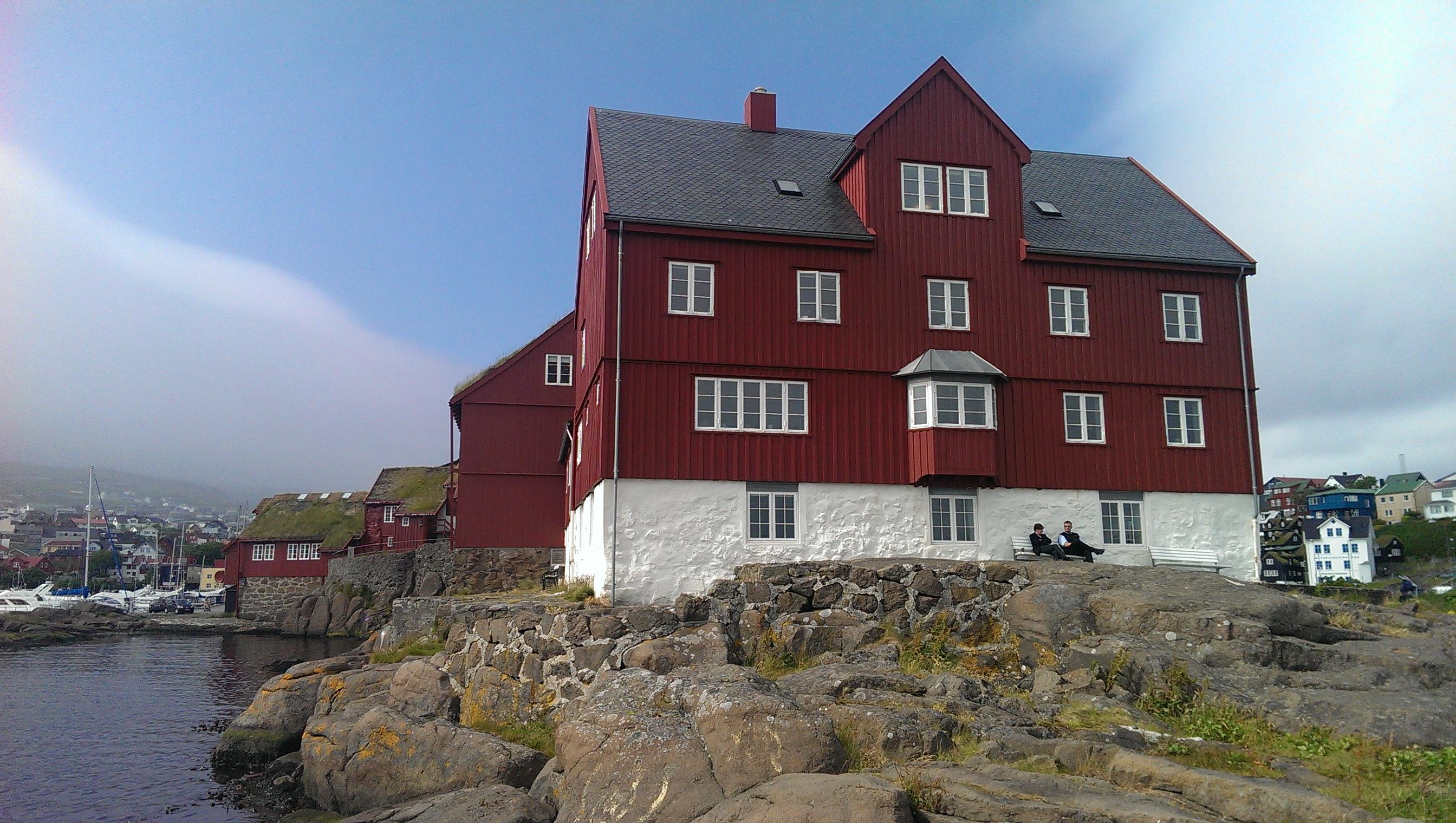 1. Parliament buildings and harbour in Torshavn
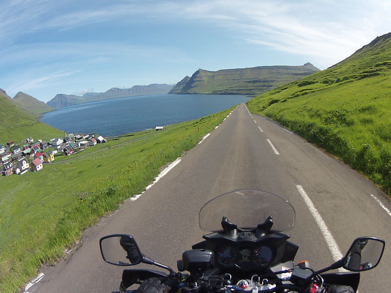 2. Road to Funningsfjordur, Esturoy
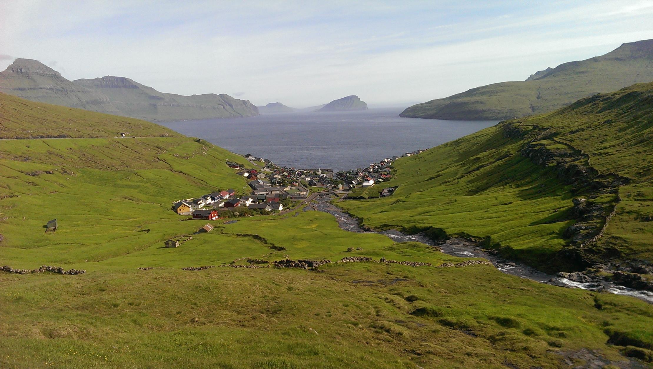 3. Kvivik village on Streymoy
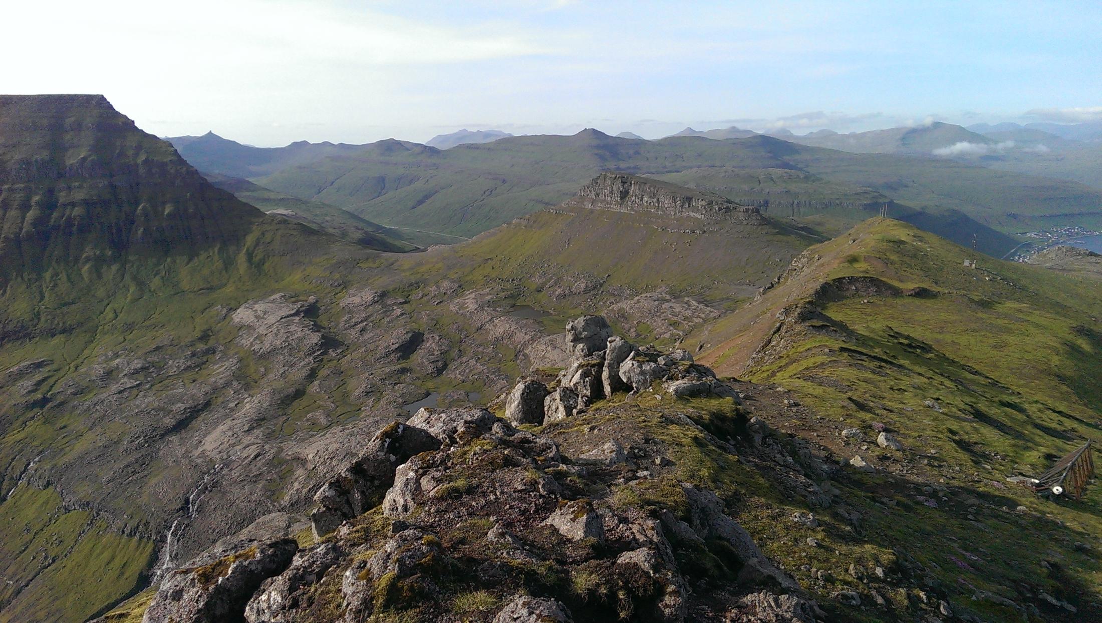 4. View from Sornfelli, Streymoy
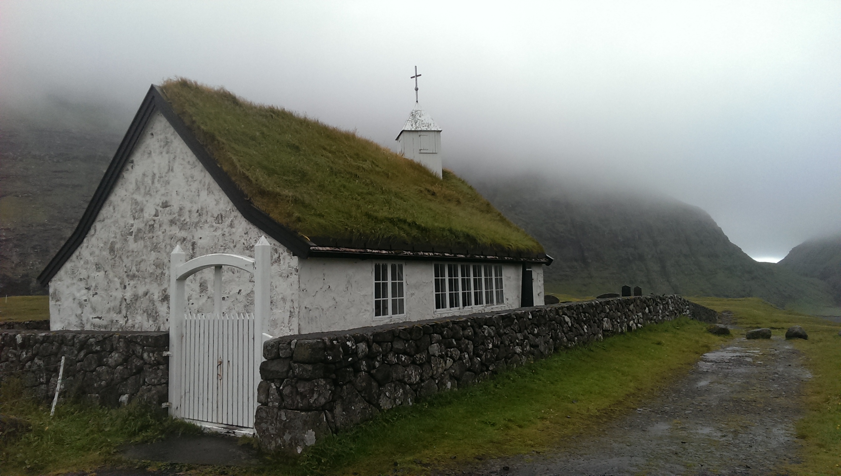 5. Saksun church, Streymoy
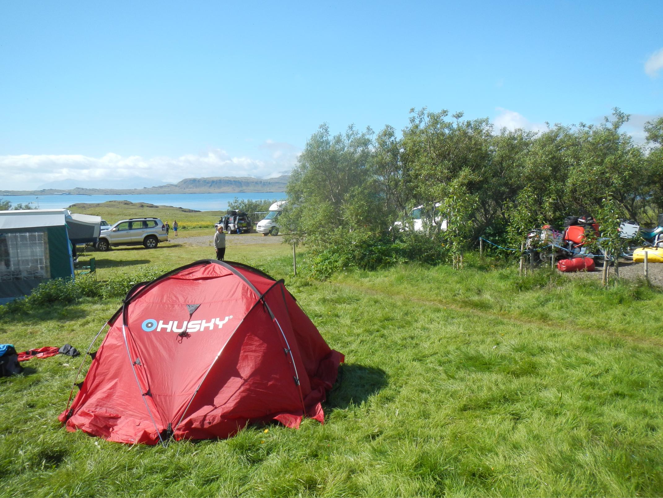
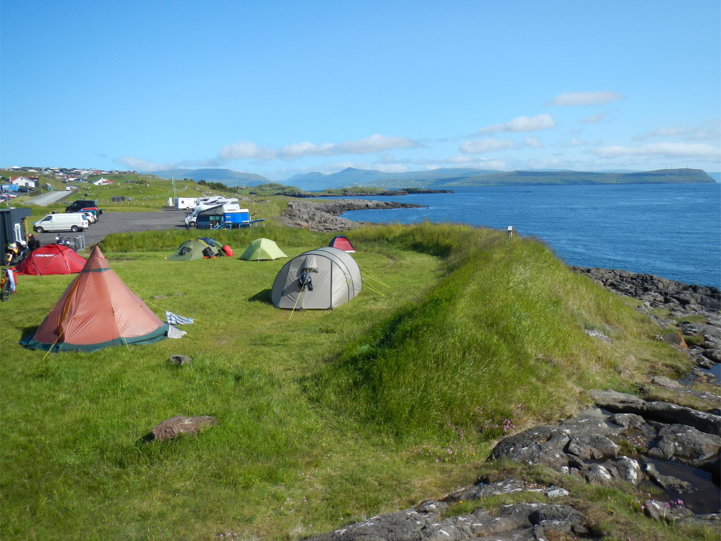 6. Torshavn campsite
 7. Route 955
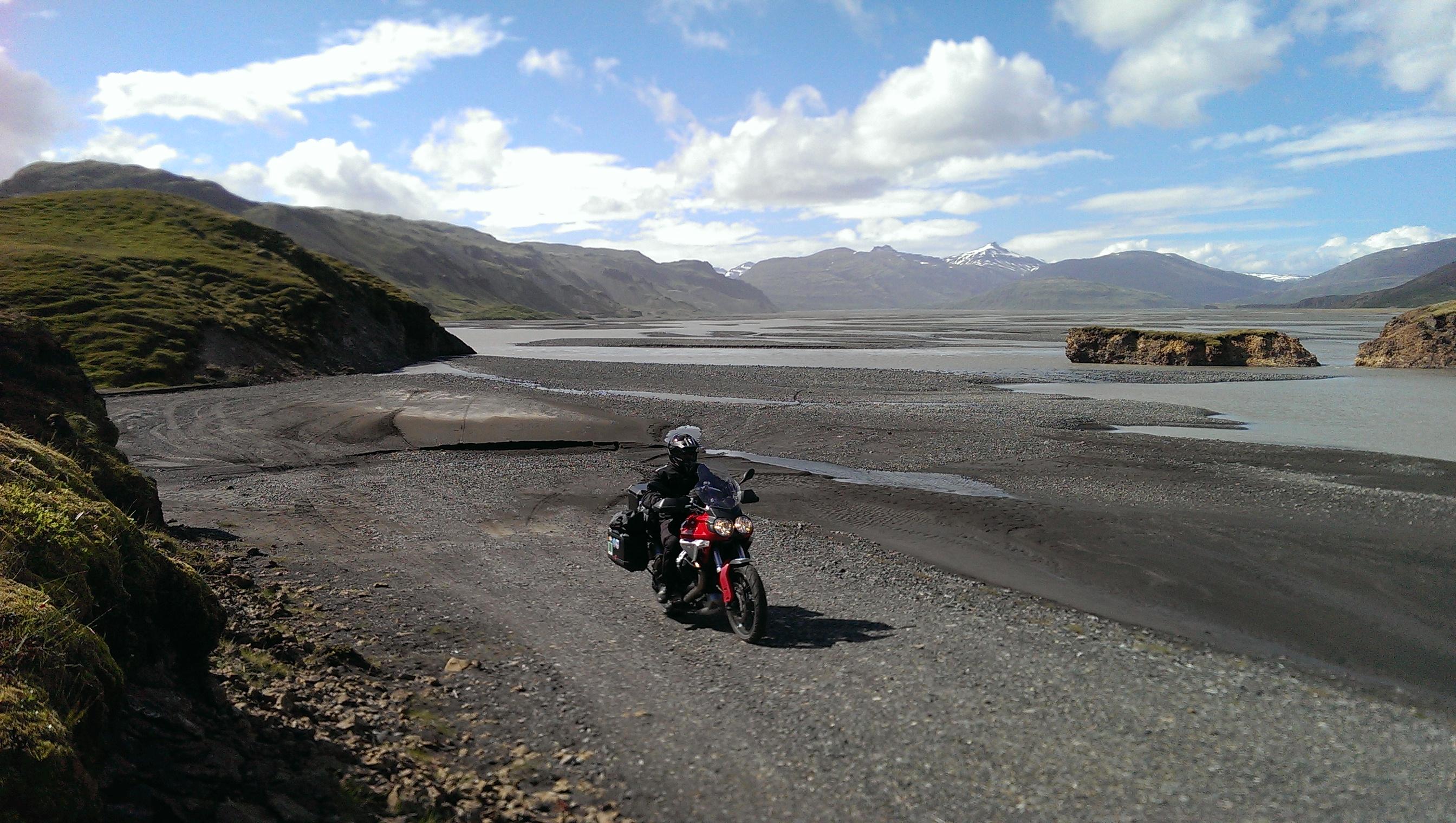 8. Ford on the F980
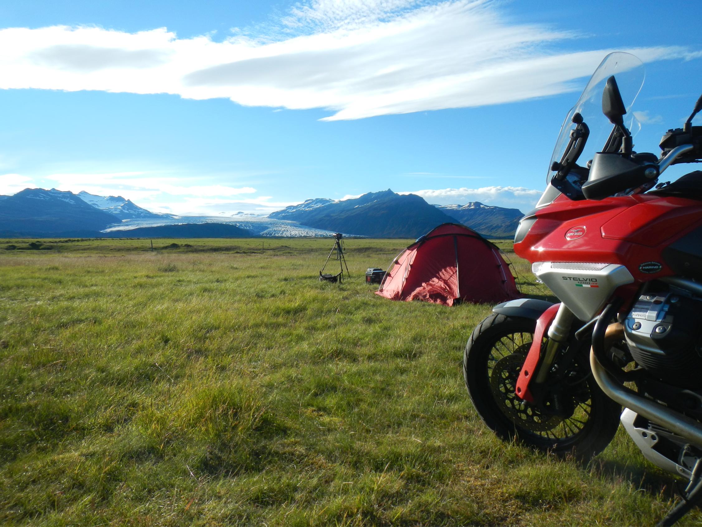 9. Lambhus campsite and Flaajokull glacier
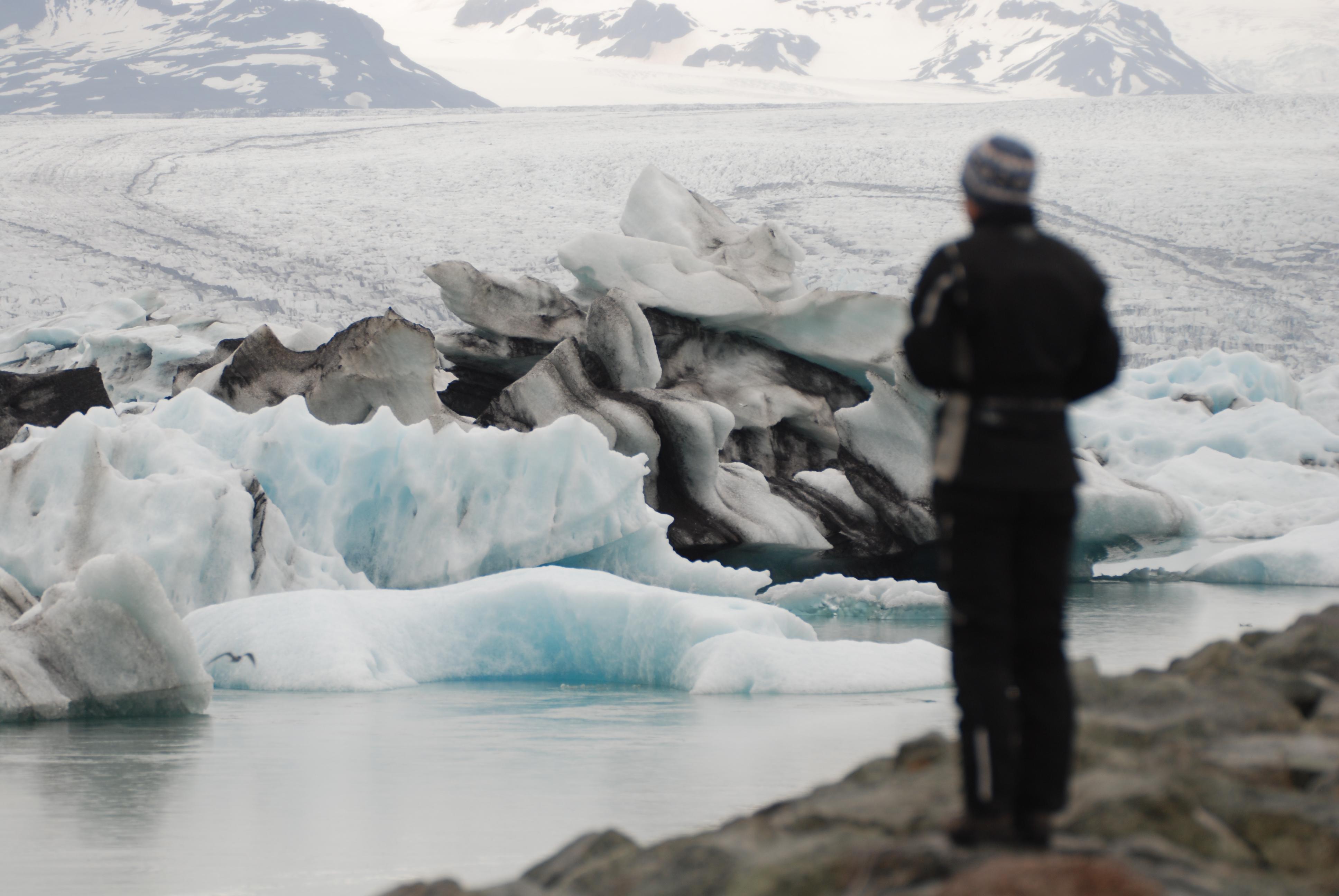 10. Jokulsarlon iceberg lagoon
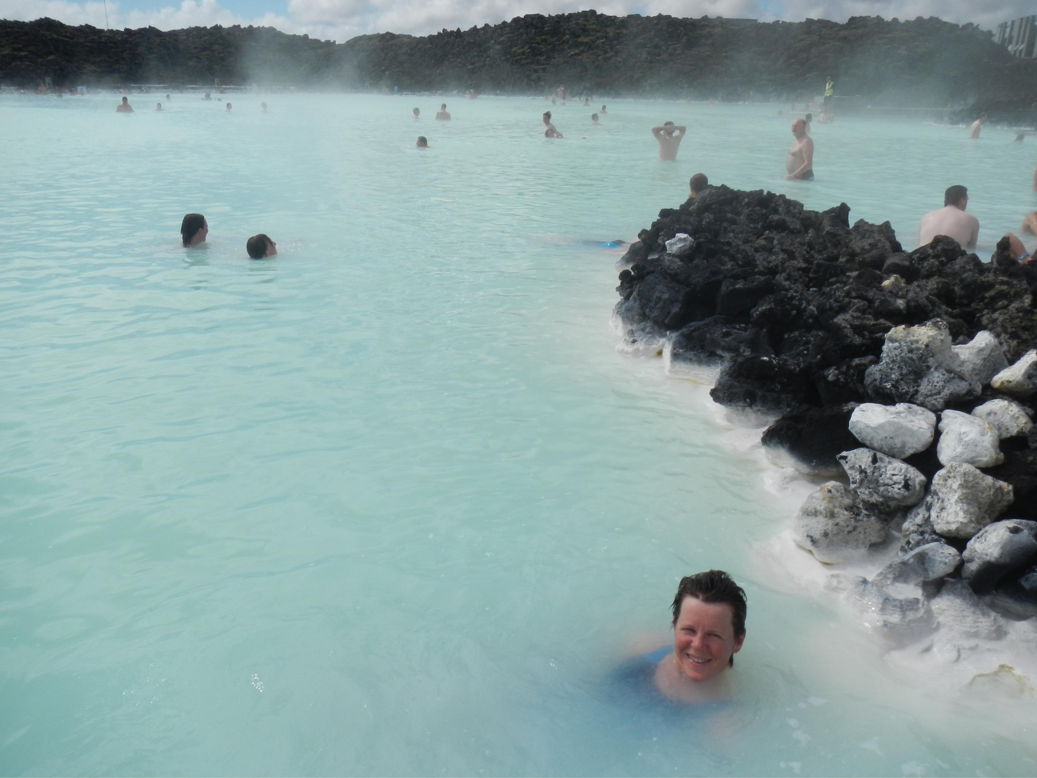 11. The Blue Lagoon
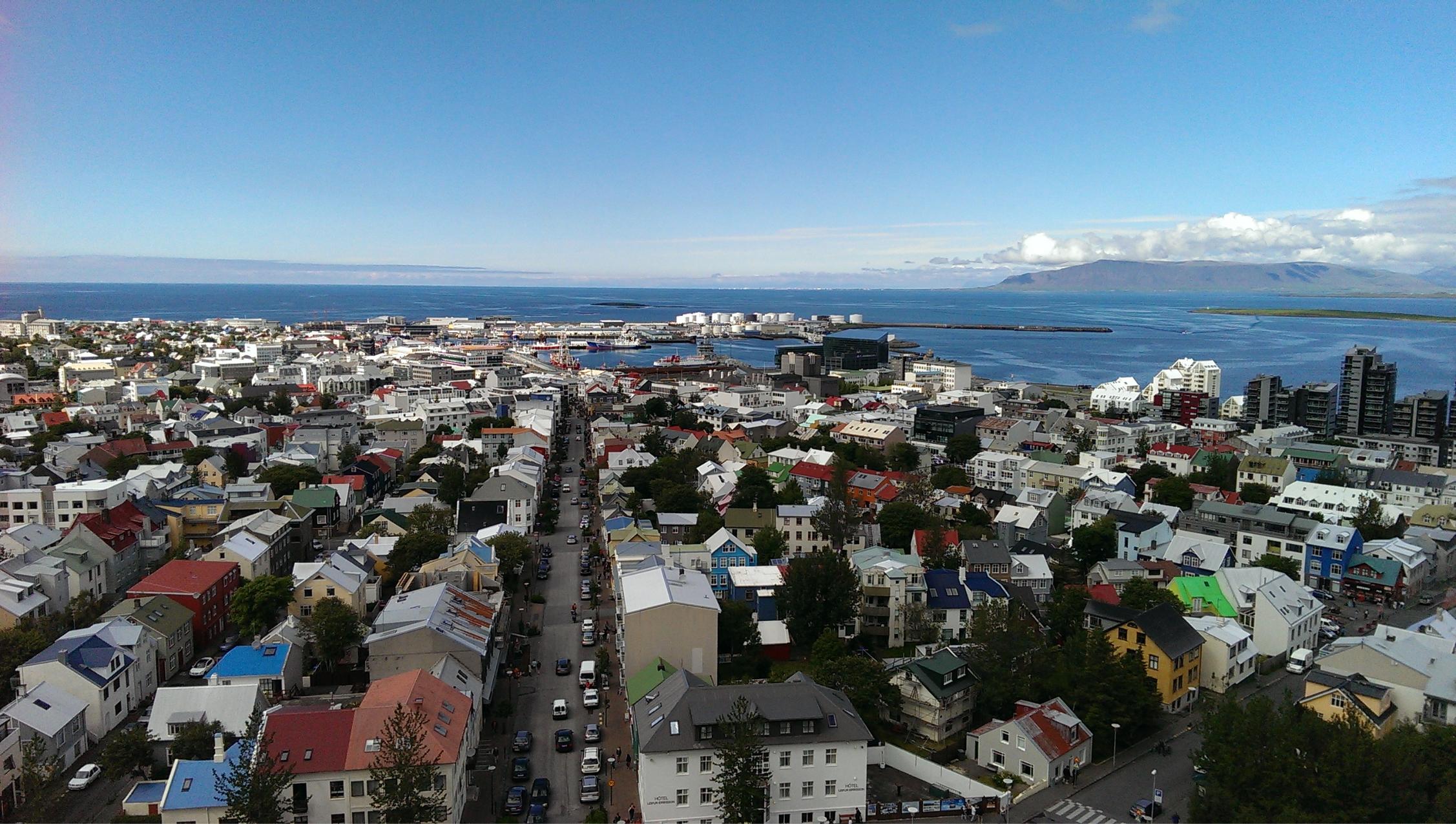 12. View of Reykjavik from the church tower
 13. Reykjavik church
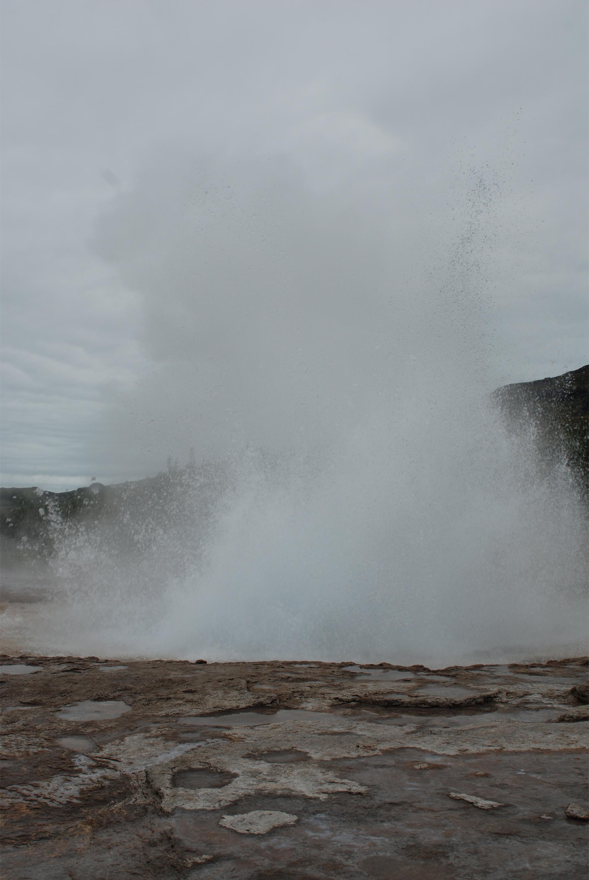 14. Strokkur geysir
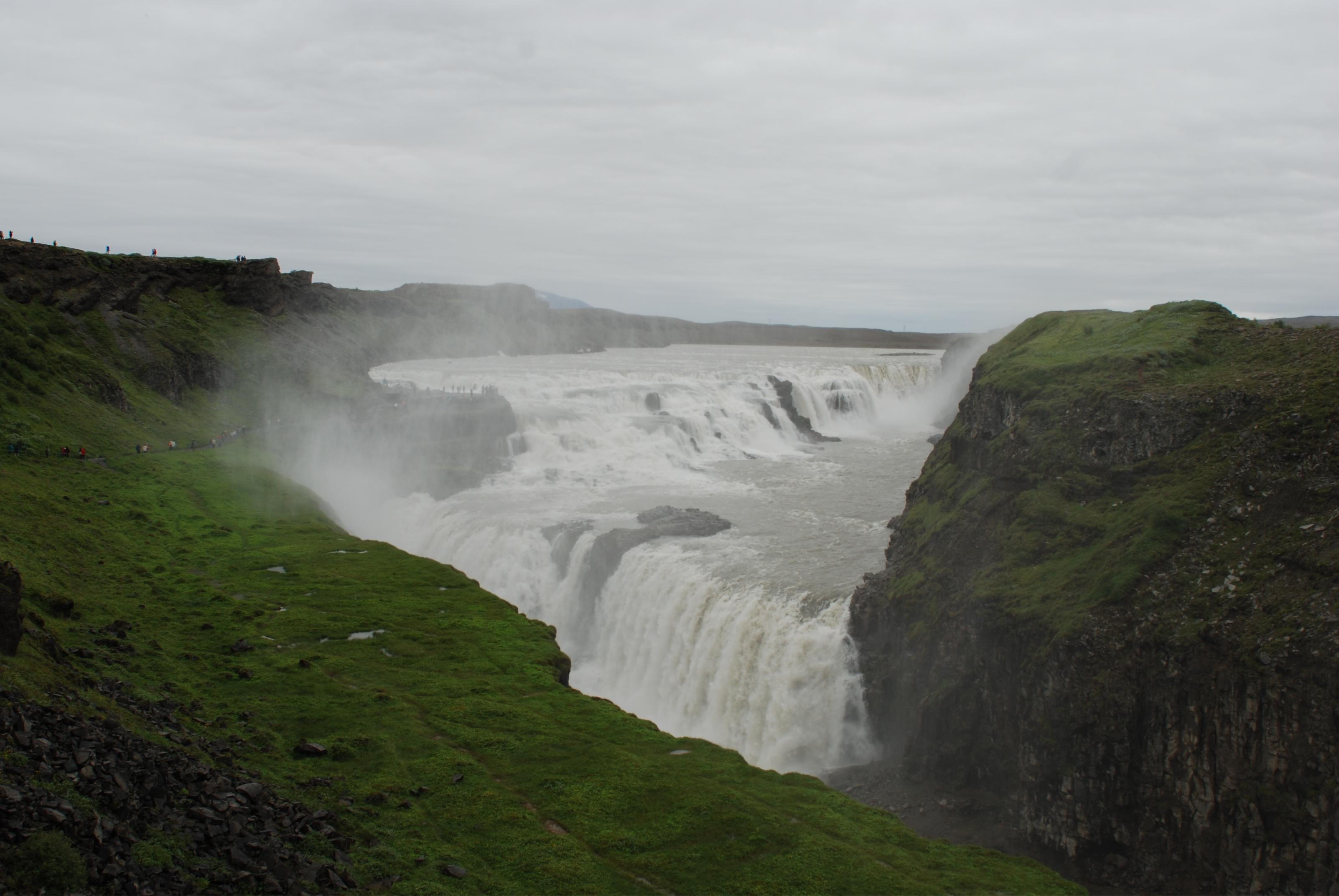 15. Gullfoss waterfall
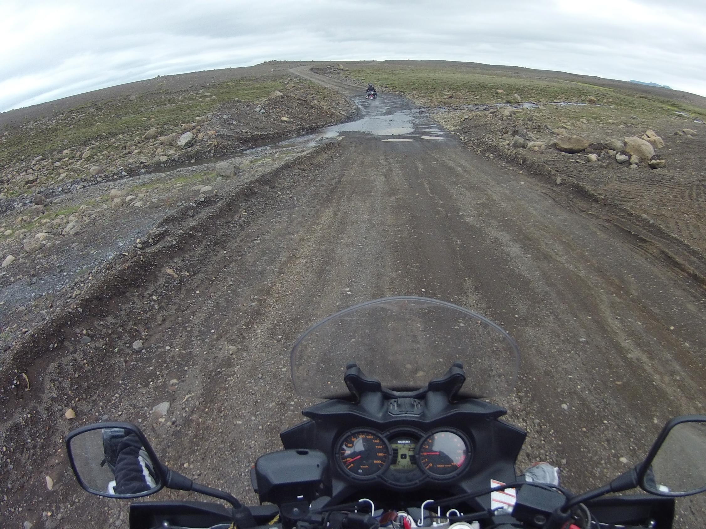 16. On the F35 mountain road
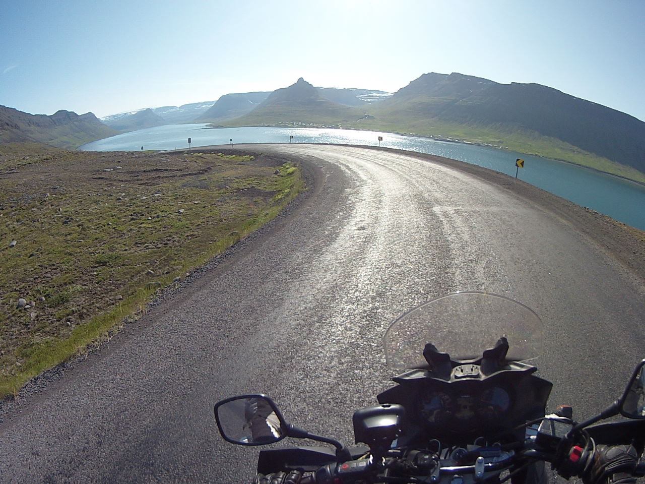 17. Route 61 in the Westfjords
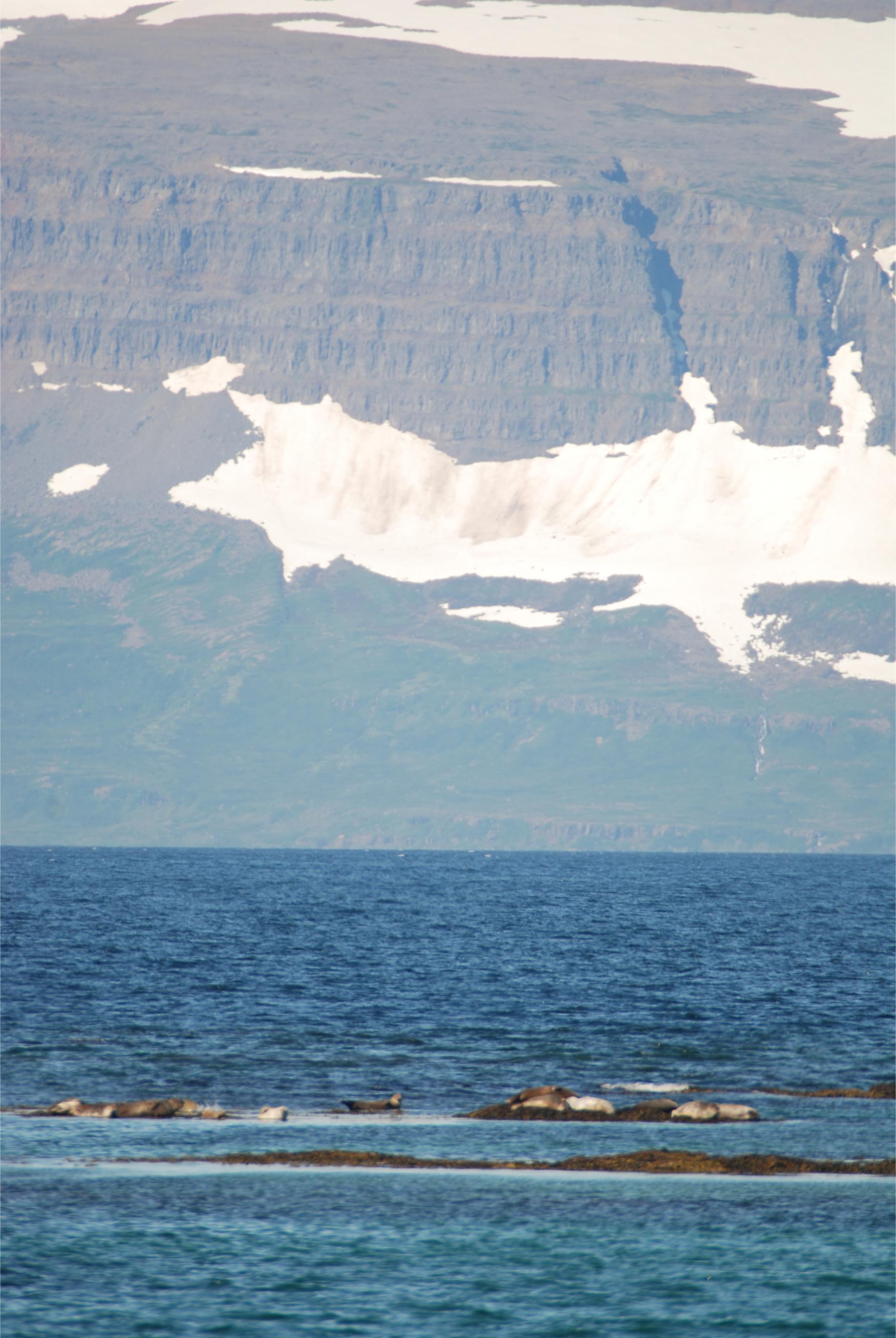 18. Seals at Hvitanes in the Westfjords
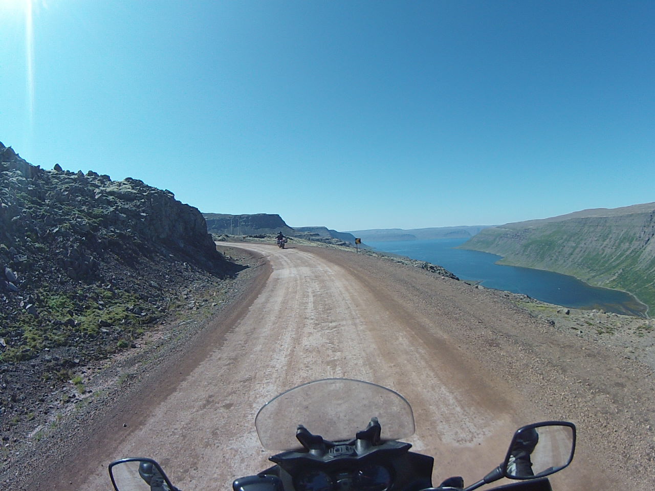 19. Route 60 in the Westfjords
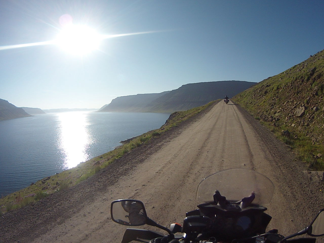 20. Route 60 in the Westfjords
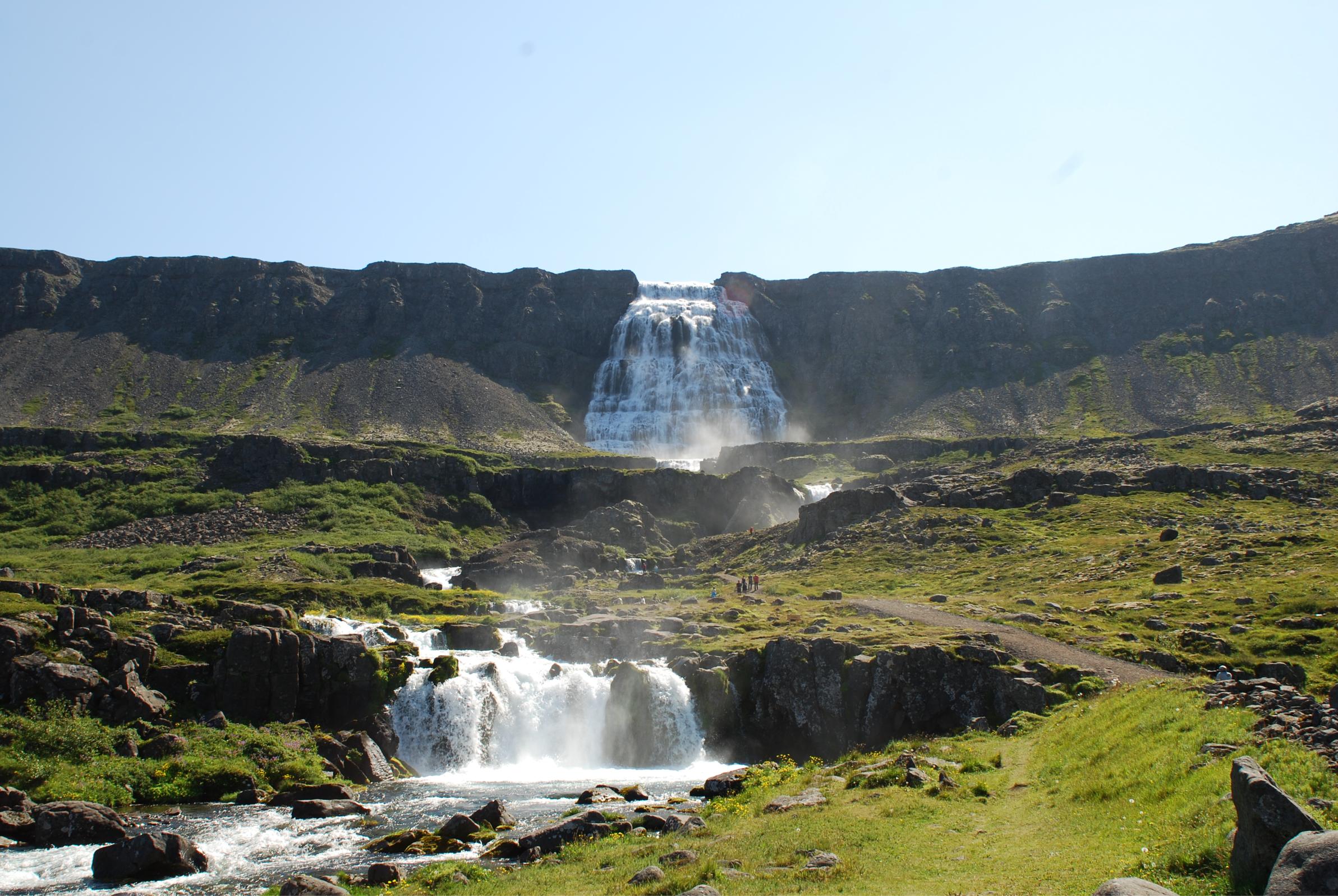 21. Dynjandi waterfall, Westfjords
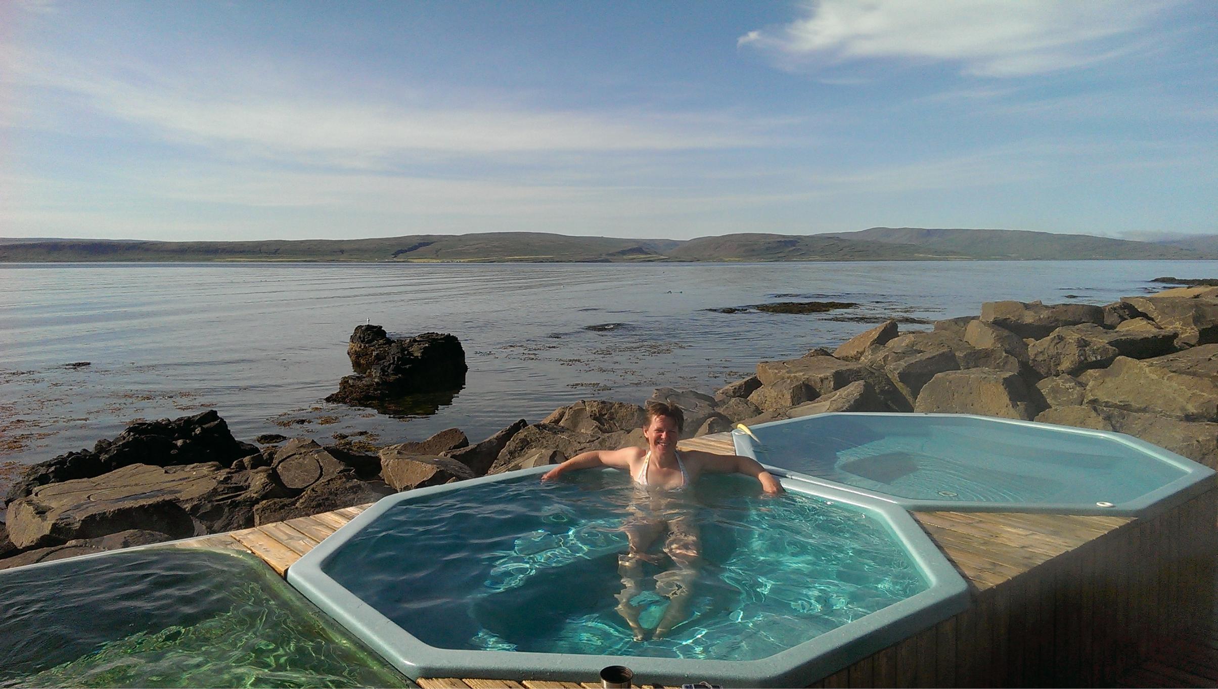 22. Drangsnes hot tubs
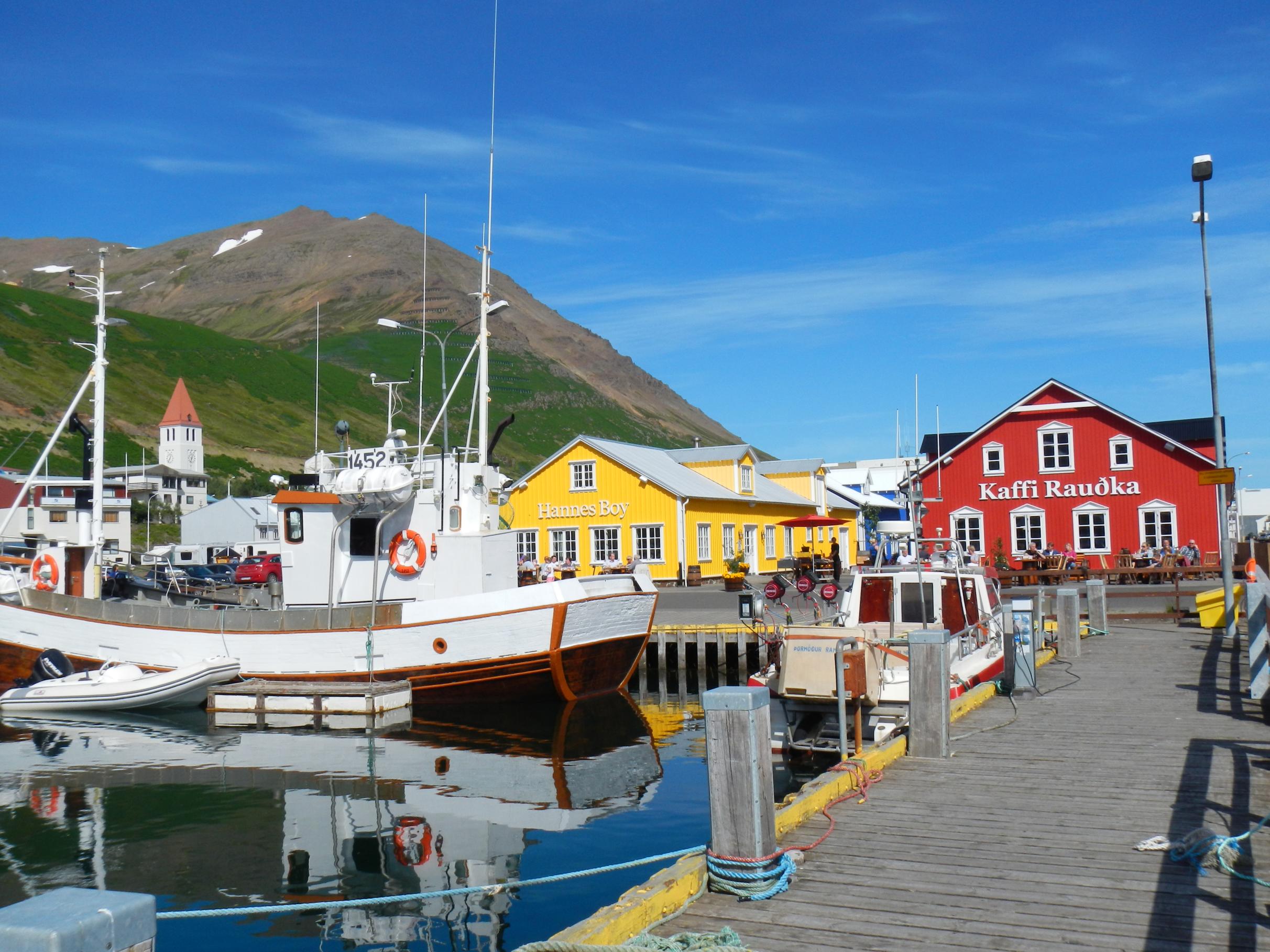 23. Siglufjordur
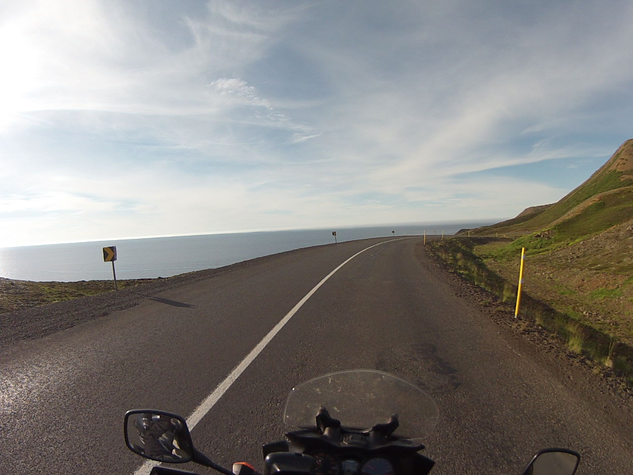 24. Route 76 to Siglufjordur
 25. Akureyri
 26. Godafoss waterfall
 27. Humpback whale in Skalfandi Bay
 28. Wednesday evening concert in Seydisfjordur church
 29. Berunes campsite
 30. Campsite at Vik
 31. Skagastrond campsite
 32. Swimming pool and hot tubs at Reykholar campsite
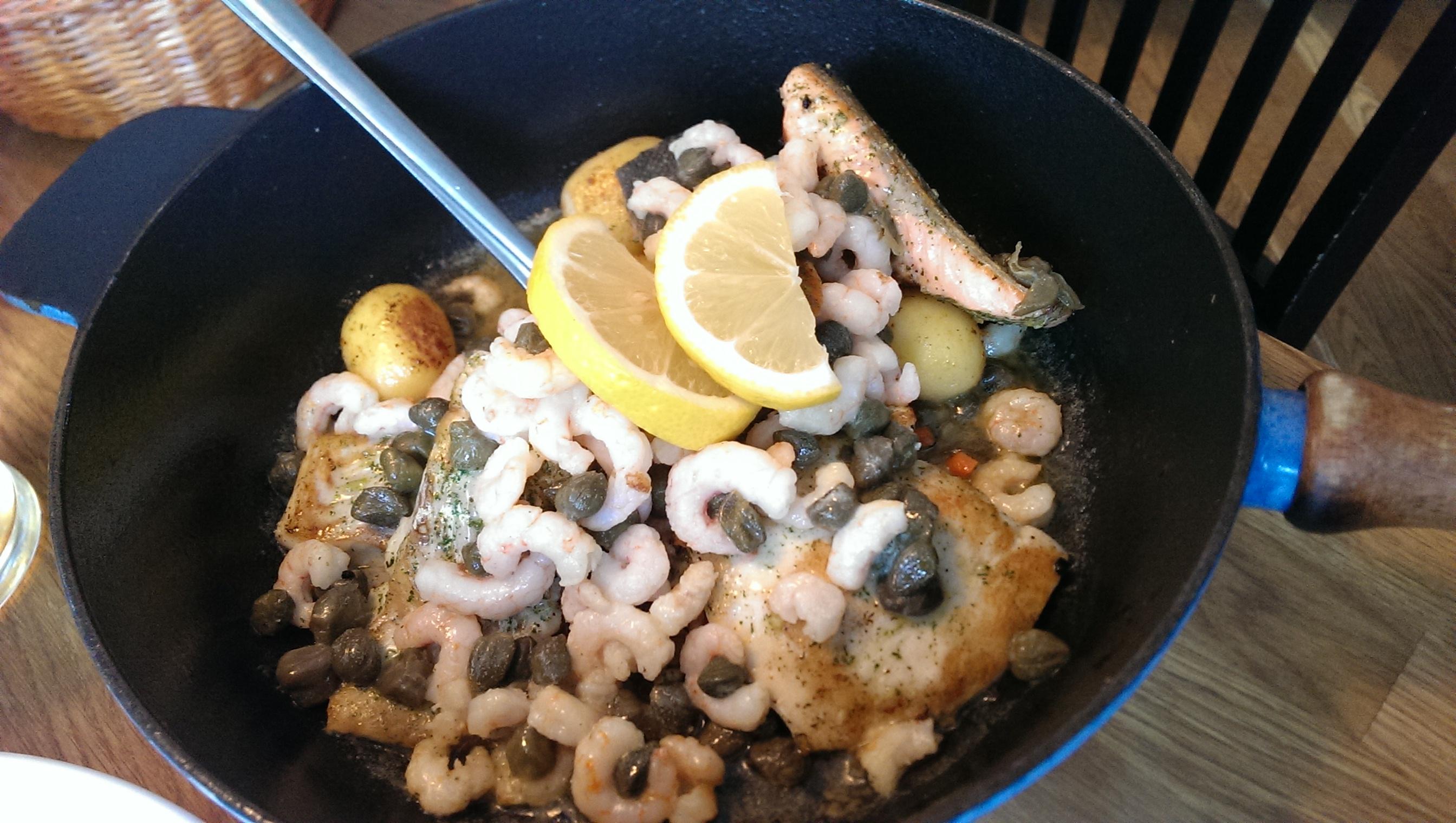 33. Fish skillet at Edinborg restaurant, Isafjordur
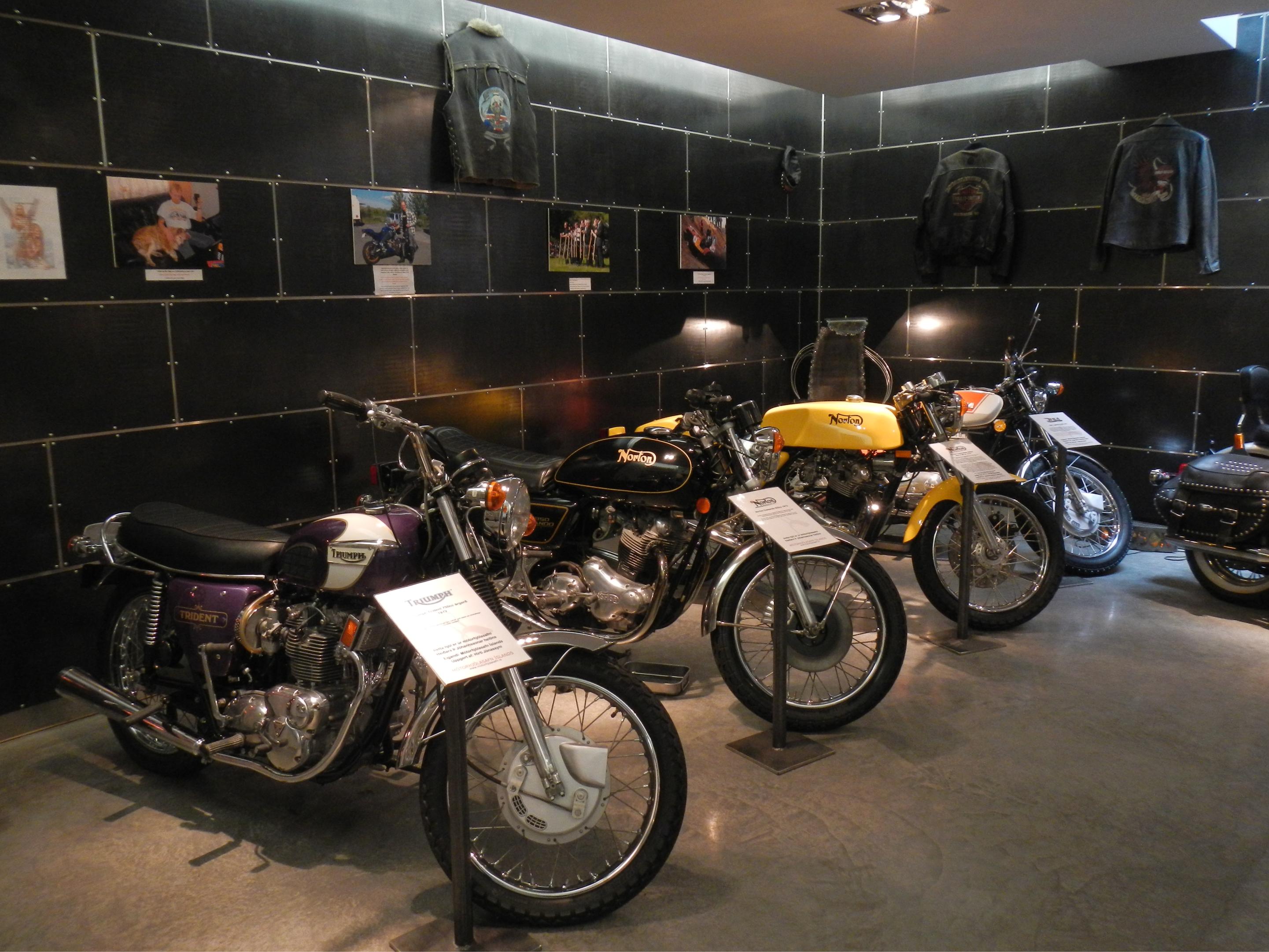 34. Motorcycle museum, Akureyri
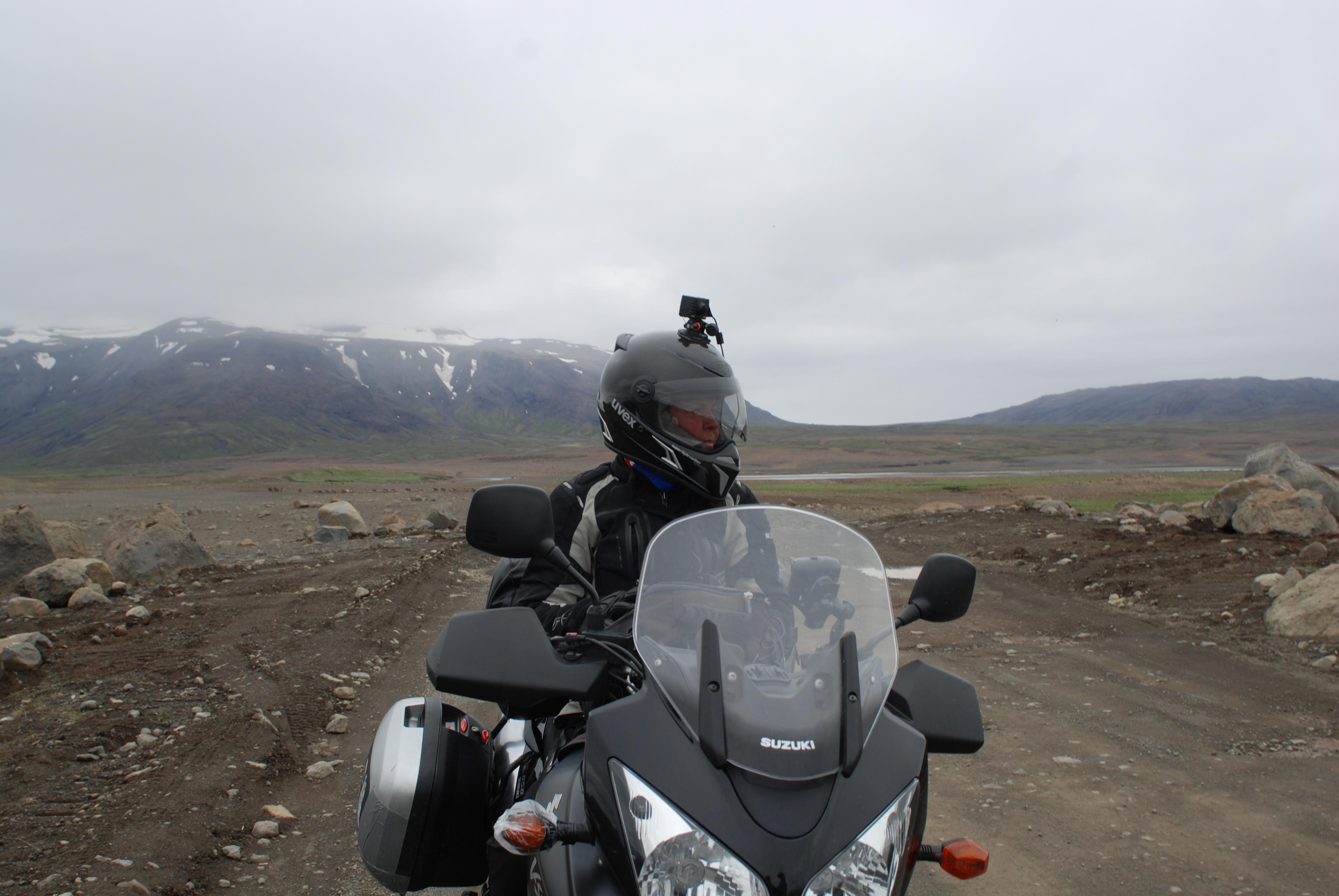 35. Recording via Rollei Bullet helmet camera
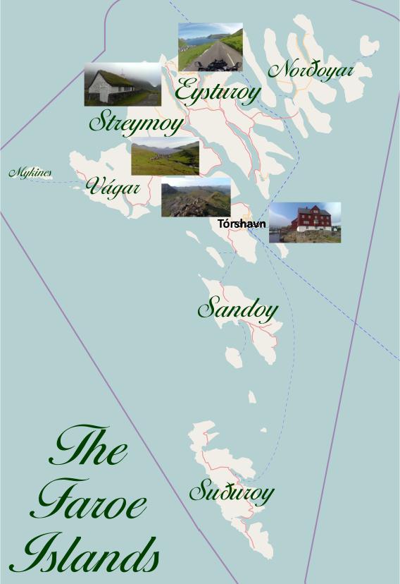 Faroe Islands map
 Iceland map