2008 - Around the coast of Ireland
Date of tour: June-July 2008 (3½ weeks)
Distance travelled: approx. 6000km (including to and from southern Germany)
Total cost of tour (for two people): €3,300
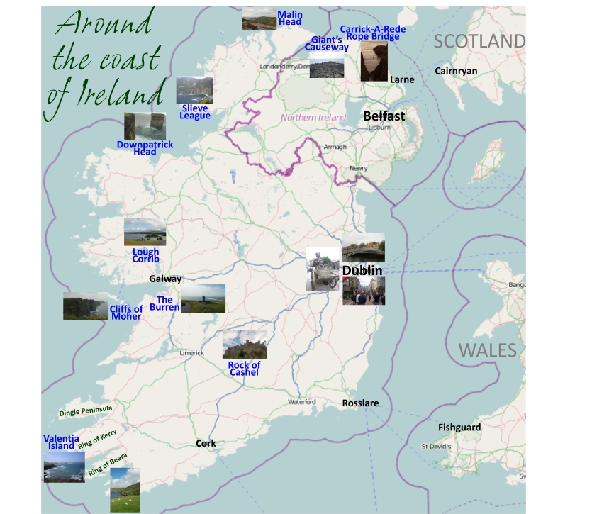
Map showing points of interest
Getting there and around
To get to Ireland from mainland Europe, one route to take is the DFDS service from Amsterdam to Newcastle. On arriving in Newcastle, head to Cairnryan on the southwest coast of Scotland (170 miles), where Stena Line operates a regular ferry service to Northern Ireland. We chose to take the route to Larne and to follow the Irish coast in an anti-clockwise direction, leaving Ireland from Rosslare on the southeast coast to Fishguard in Wales.
Alternatively, Irish Ferries, Brittany Ferries and Celtic Link all sail directly to Ireland from France. Stena Line sails from the Hook of Holland to Harwich and from Liverpool and Wales to Ireland. P&O Ferries operates services from Zeebrugge to Hull and from Liverpool to Dublin.
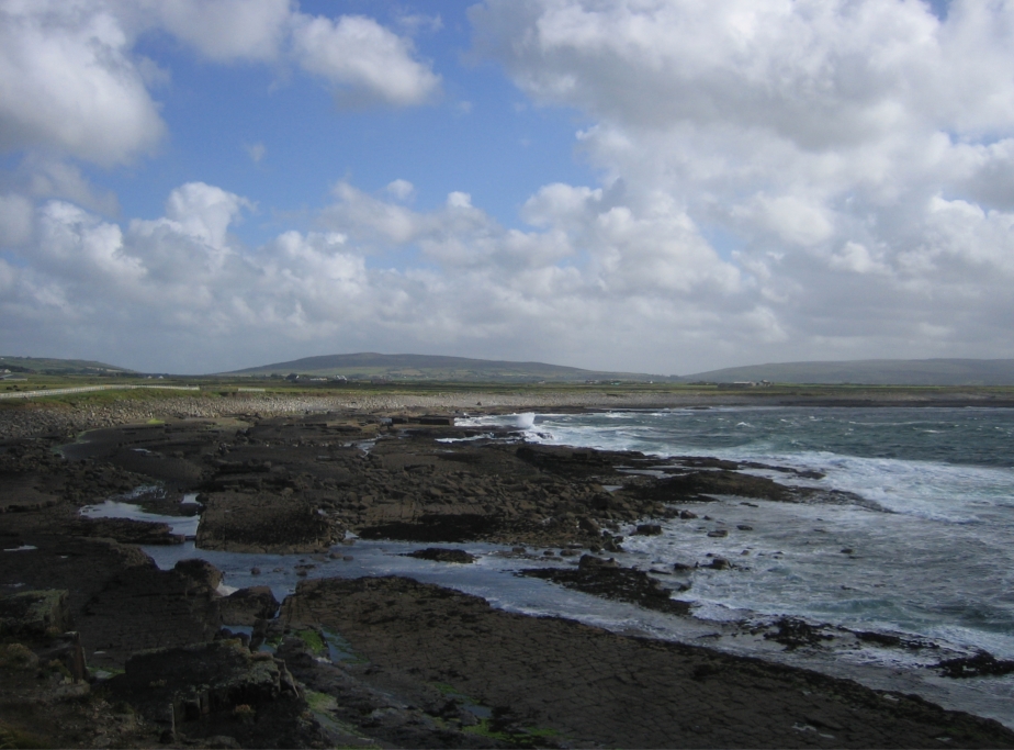
There are short ferry crossings within Ireland, for example, across the larger rivers, such as the Shannon.
Good motorbiking routes
Click on the photos on the right to enlarge them.
1. From the ferry port of Larne, a scenic road follows the coastline northwest, past sandy and shingle beaches and views of Scotland on a clear day (see Photo 1). After Cushendall it heads inland over slightly higher ground and along the edge of Ballypatrick Forest until it reaches the town of Ballycastle. Just past Ballycastle is the small village of Ballintoy, home to the Carrick-A-Rede Rope Bridge (Photo 2) and a very good hostel (see Accommodation and Worth a visit below).
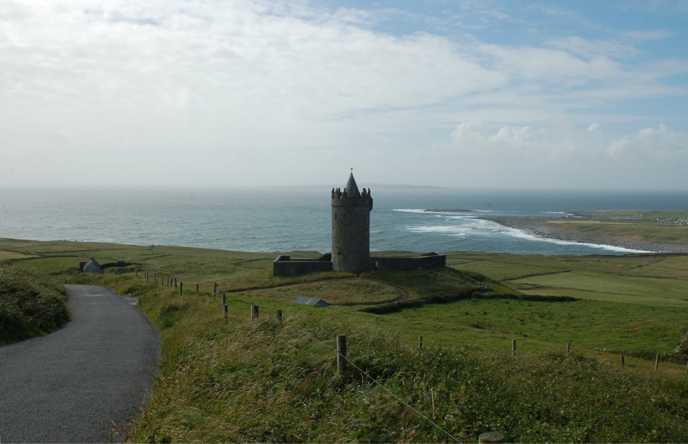
2. The scenic route continues west along the A2, past one of Northern Ireland's most popular tourist attractions, the Giant's Causeway (see Photo 3 and Worth a visit below), the famous Bushmills Whiskey Distillery and the ruin of Dunluce Castle (Photo 4). Around 15 miles after Coleraine, the B202 leads up to the Lough Foyle ferry (summer only) where you can cross to Inishowen Peninsula in County Donegal in the Republic of Ireland. At the northern tip of this peninsula is Malin Head, the northernmost point of Ireland (Photo 5). County Donegal is a wild and rugged place and the weather there is extremely unpredictable.
3. To leave Inishowen Peninsula, there is a ferry across Lough Swilly from Buncrana to Rathmullan. There are some very interesting motorcycling roads between Rathmullan and Killybegs (for Killybegs see Accommodation below) on the southwest coast of Donegal, especially the 900m Glengesh Pass and the road up to Slieve League, which, at 600m, are the highest cliffs in Europe (Photo 6). To reach the cliffs at Slieve League, take the road from Carrick signposted Bunglass. If it's raining before you start the ascent to the cliffs, wait 10 minutes - it'll soon clear.
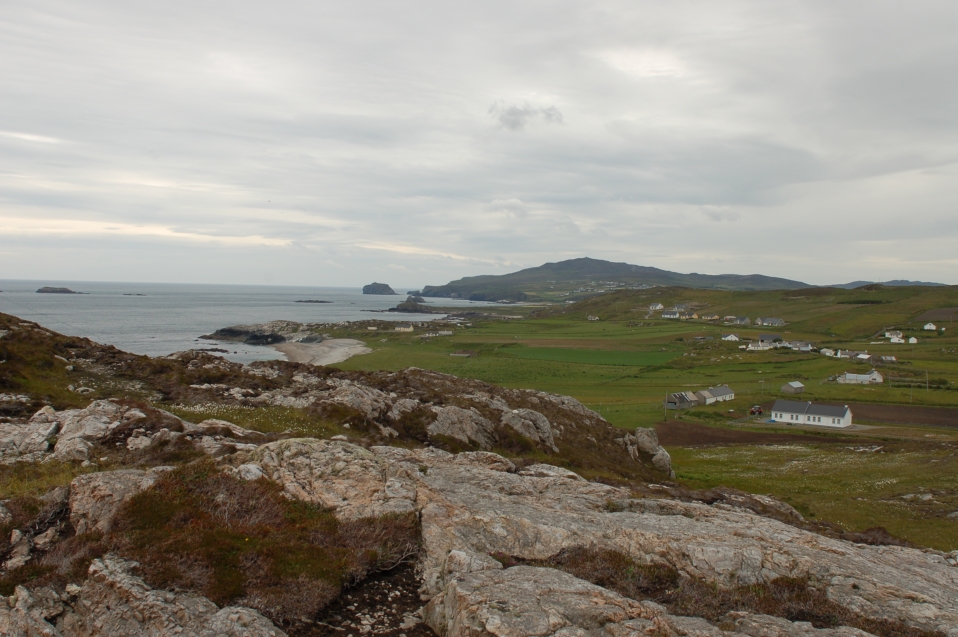
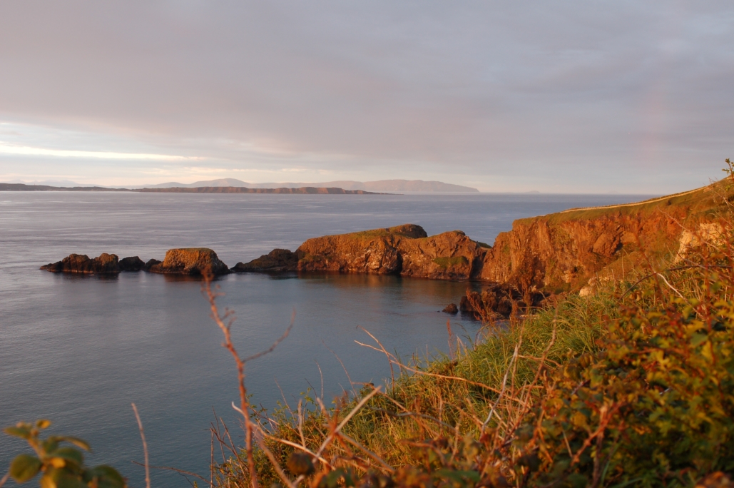
4. Continuing south, the N15 and then N59 skirt the coastline and provide magnificent views over Donegal Bay and the Atlantic (Photo 7). After Ballina, the R314 north to Downpatrick Head (see Photo 8 and Worth a visit below) and onwards to the village of Pollatomish (see Accommodation below) also offers beautiful sea views.
5. There are lots of interesting smaller roads in this area to explore (but watch out for the potholes), before resuming the N59 south to Westport, where the R335 branches off through the dramatic Doolough Valley. (Unfortunately I don't have any nice pictures of this valley as the weather was so miserable as we rode through it, although at the end we arrived at Lough Corrib and took Photo 9).
6. South of Galway, three notable sights are worth stopping for (see Dunguaire Castle, the Burren and Cliffs of Moher in Worth a visit below). Take your pick of roads through the Burren - they all provide views like the one in Photo 10.
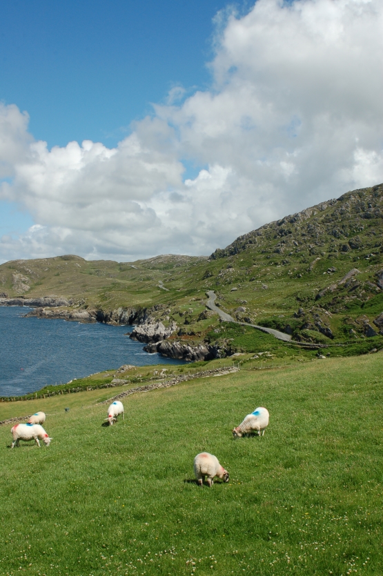
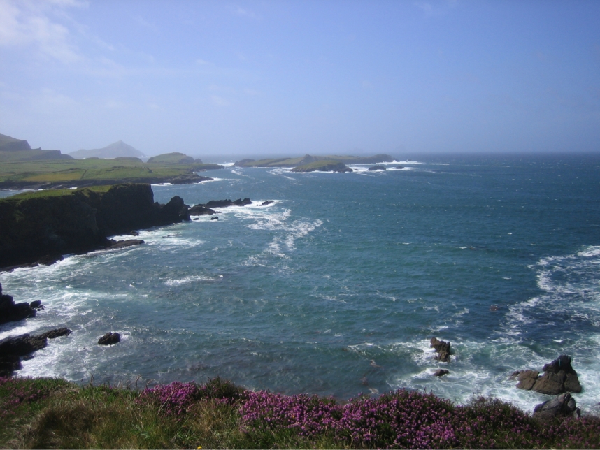
7. TOP TIP Continuing south, a 20-minute ferry journey over the mouth of the River Shannon takes you into County Kerry, which, in my opinion, has the best scenery in the whole of Ireland. For motorcyclists, three routes in County Kerry are a MUST: the Dingle Peninsula, the Ring of Kerry and the Ring of Beara (Photo 11). Motorists are advised to travel around the Ring of Kerry anti-clockwise to ease traffic. While doing the Ring of Kerry, Valentia Island is well worth a stop-off (Photo 12). The campsite at Caherdaniel (see Accommodation below) is a good base for exploring these three peninsulas.
8. Leaving the remoteness of these peninsulas, the larger towns in the area are Killarney and Cork. From Cork, a day tour to the Rock of Cashel (see Photo 13 and Worth a visit below) takes you over the Knockmealdown Mountains. Head to Lismore on the R627, then take the R668 north to catch some hairpin bends.
Accommodation
TOP TIP Sheep Island View Hostel in Ballintoy on Northern Ireland's northeast coast offers high quality accommodation at good rates. The Fullerton Arms in the village does excellent pub food. From Ballintoy there are superb views across the Irish sea to Scotland (Photo 14).
Killybegs, on the southwest coast of County Donegal, is a pleasant little harbour town and Ireland's most important fishing port. The Ritz Hostel (named after the cinema that it used to be) is in a prime location in the town and has excellent facilities.
Kilcommon Lodge in the tiny village of Pollatomish in County Mayo is highly recommendable.
TOP TIP Wave Crest Caravan and Camping Park near Caherdaniel on the Ring of Kerry has excellent facilities and superb sea views.
Sheila's Hostel is a safe and clean hostel in a central location in Cork town. There is a public car park directly outside the hostel which seemed to be safe.
The nearest campsite to Dublin is Camac Valley Caravan and Camping Park, which is about 17km from the city centre. It's large and safe and a there's a regular bus to the city from just outside the campsite.
Worth a visit
1. Carrick-A-Rede Rope Bridge (Photo 2) near Ballintoy on the northeast coast was once used by local fishermen who needed access to Carrick-A-Rede island. The modern rope bridge is safer to traverse than the original, but can still be scary for vertigo sufferers standing on a few pieces of wood 23 metres above the waves.
2. Legend has it that the mythical Giant's Causeway (Photo 3), which is made up of large, flat hexagonal columns, was carved out of the basalt rock by the giant Finn McCool in trying to reach his Scottish adversary (there is a similar structure across the Irish Sea in Fingal's Cave on the Scottish island of Staffa). Visiting the causeway is free but there is a charge for the car park (bikes are safe there). The causeway gets quite busy with tourists so plan to visit off peak times.
3. Ireland is full of legends and Downpatrick Head is no exception. It is said to be the point where St Patrick, the patron saint of Ireland, banished all snakes from Ireland with a blow from his staff which separated the sea stack known as Dún Briste from the mainland (Photo 8). (Evidence suggests, however, that there have never been any snakes in Ireland.) Take care when walking towards the sea stack as there are blowholes hidden underfoot.
4. In Galway Bay, near the small town of Kinvarre, stands Dunguaire Castle (Photo 15), one of the most photographed castles in Ireland. South of Galway Bay is an extraordinary natural phenomenon; it is possibly the only place in the world where, due to the unusual climatic conditions and the limestone rock formations, arctic, alpine and Mediterranean foliage grow alongside one another (Photo 16). Known as the Burren, this area is partly protected by a national park. To the west of the Burren, and taking the full brunt of what the Atlantic Ocean has to offer, are the majestic Cliffs of Moher (Photo 17). Although only a third of the height of the cliffs at Slieve League in County Donegal, they are one of Ireland's most popular tourist attractions.
5. The medieval castle which stands on the Rock of Cashel (Photo 13) is one of the most visited tourist attractions in Ireland. As well as exploring the castle, visitors are also treated to expansive views of the surrounding countryside.
6. Things to see in Dublin, Ireland's capital city, include the Ha'penny Bridge (Photo 18), the statue of Molly Malone (Photo 19) and the main pedestrian area (Photo 20) with numerous shops, restaurants and bars.
Recommended reading: Lonely Planet Travel Guide to Ireland
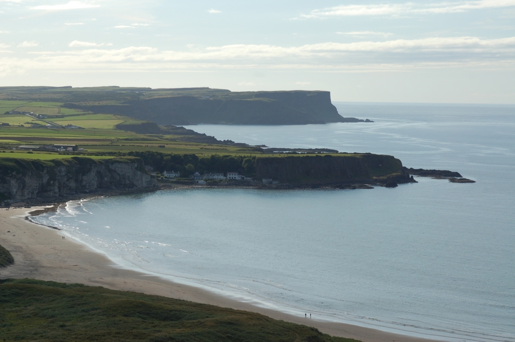 1. Northern Ireland's northeast coast
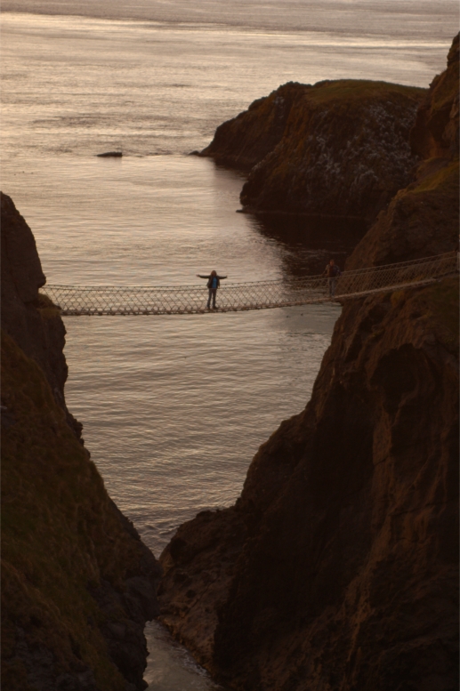 2. Carrick-a-Rede Rope Bridge near Ballintoy
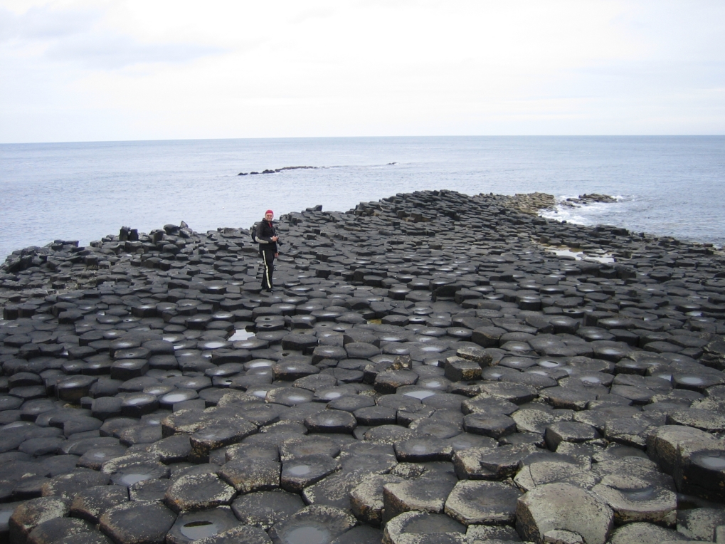 3. Giant's Causeway, Northern Ireland
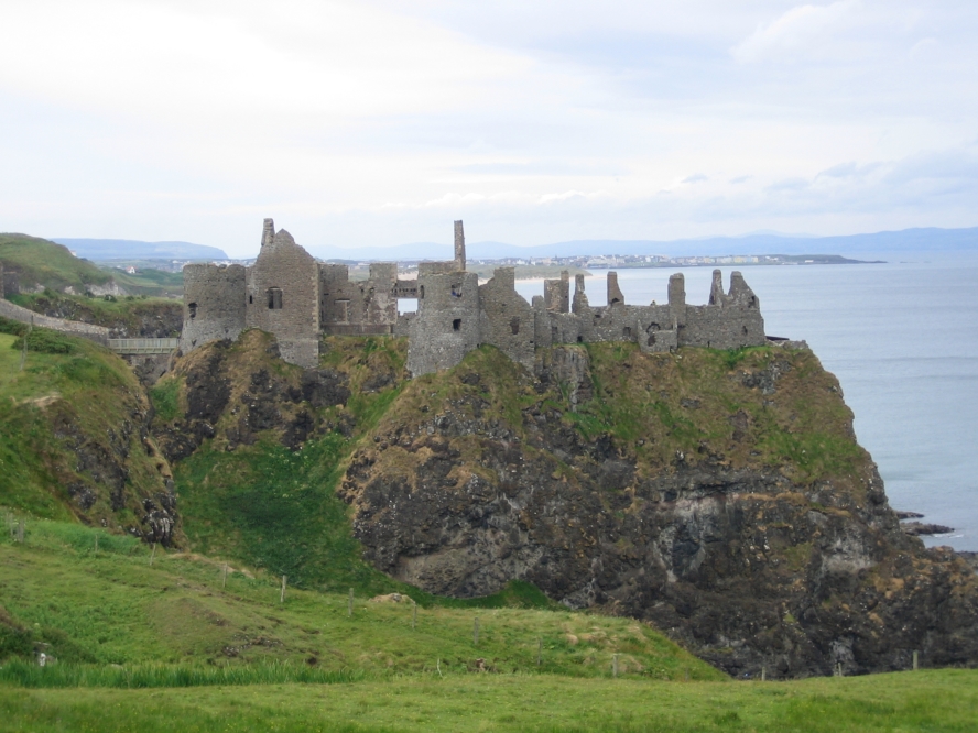 4. Dunluce Castle, Northern Ireland
 5. Malin Head, County Donegal
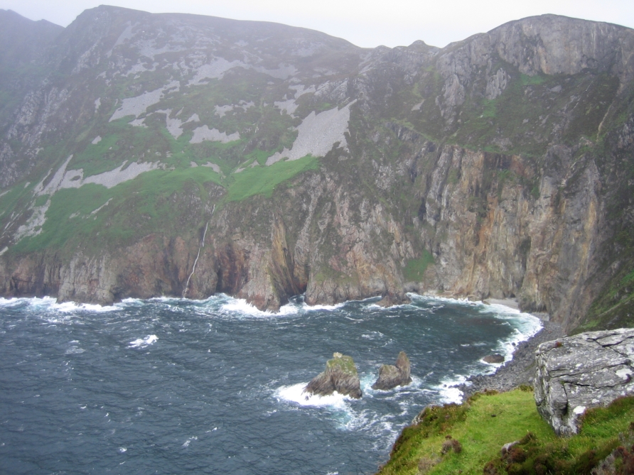 6. Slieve League, County Donegal
 7. View from the north coast of County Mayo
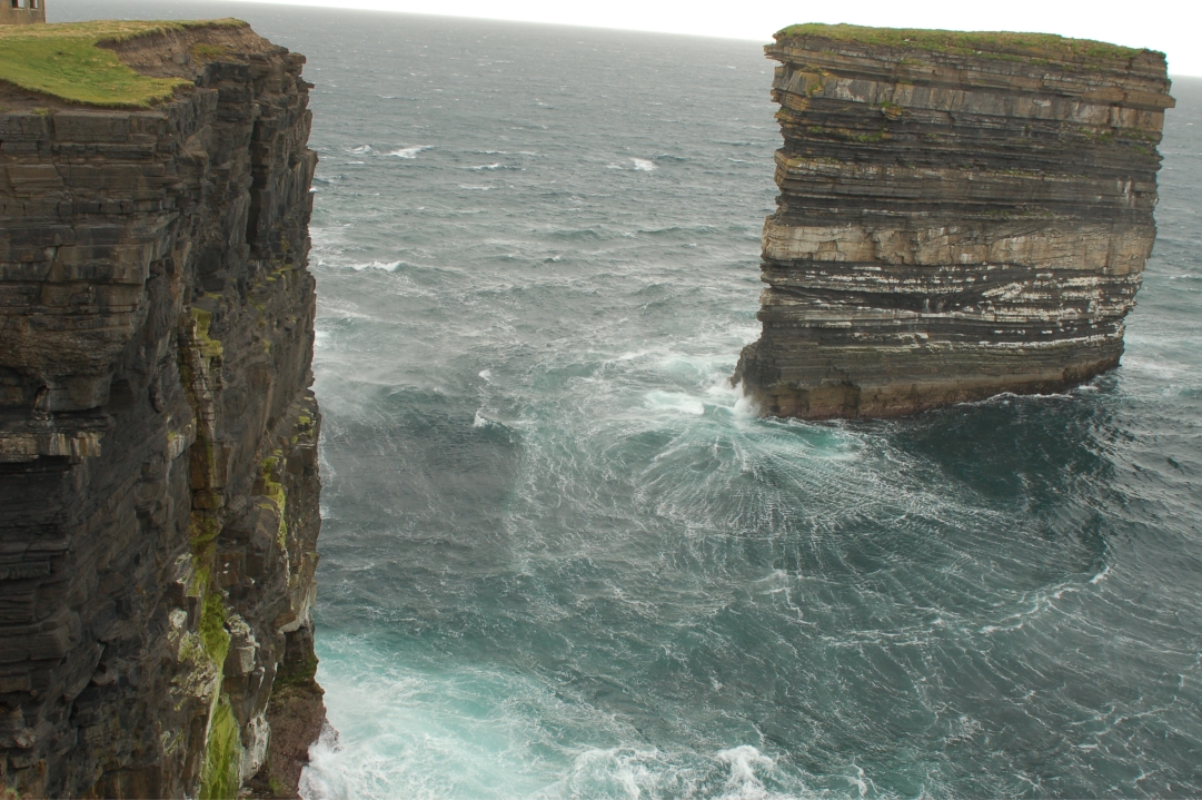 8. Dun Briste sea stack at Downpatrick Head
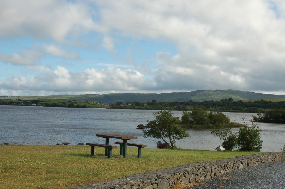 9. Picnic area at Lough Corrib
 10. Road through the Burren
 11. Road on the Ring of Beara
 12. Valentia Island, County Kerry
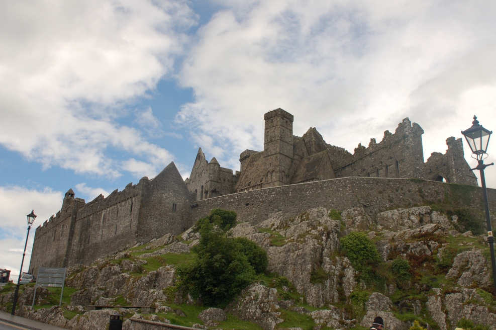 13. Rock of Cashel
 14. View from Ballintoy
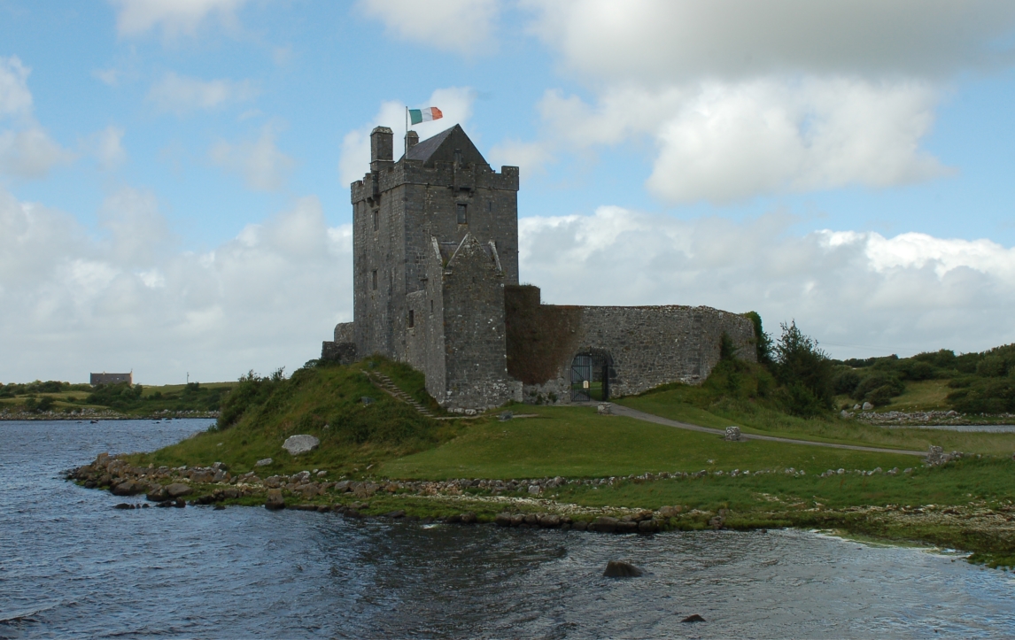 15. Dunguaire Castle near Galway
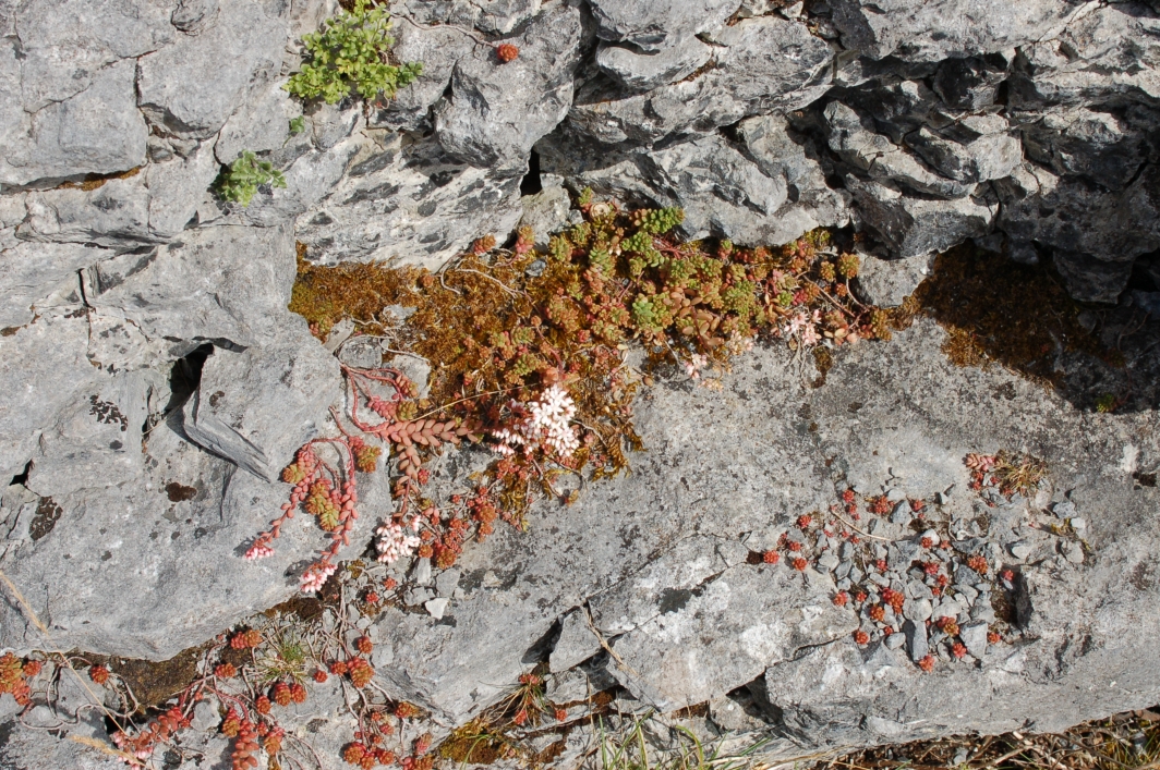 16. Vegetation in the Burren
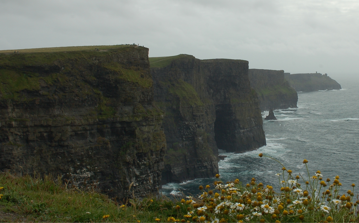 17. Cliffs of Moher
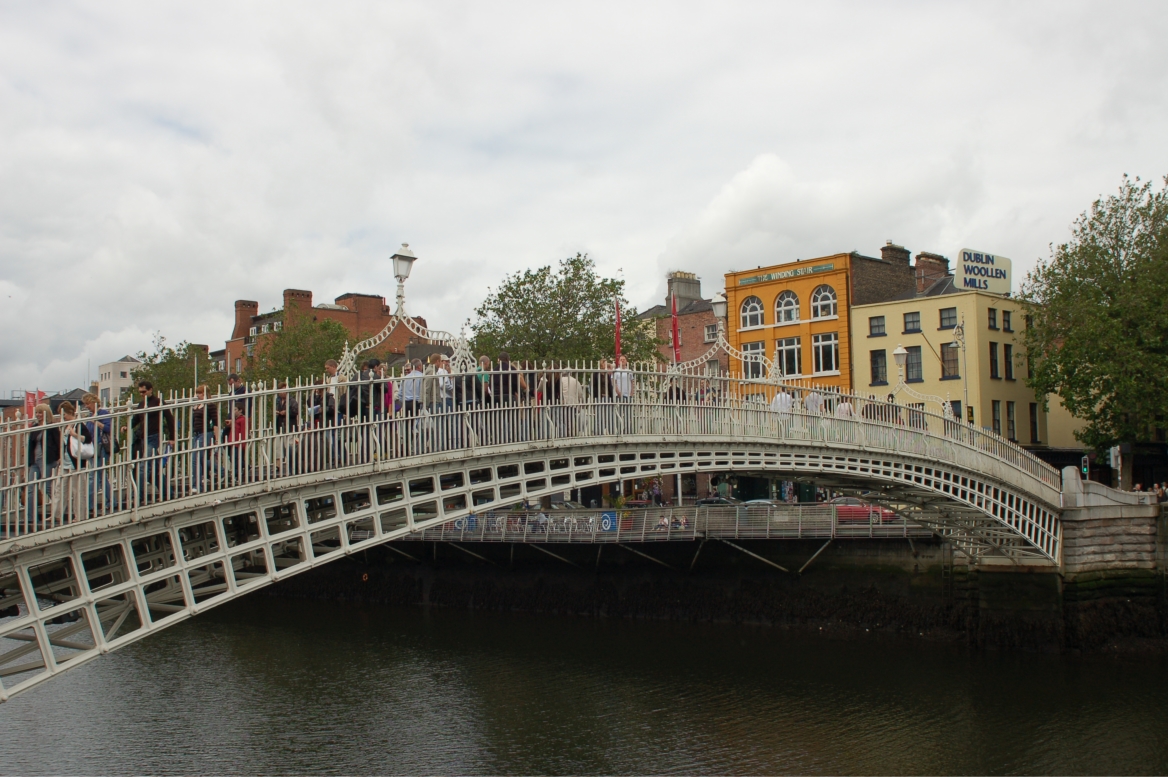 18. Ha'penny Bridge, Dublin
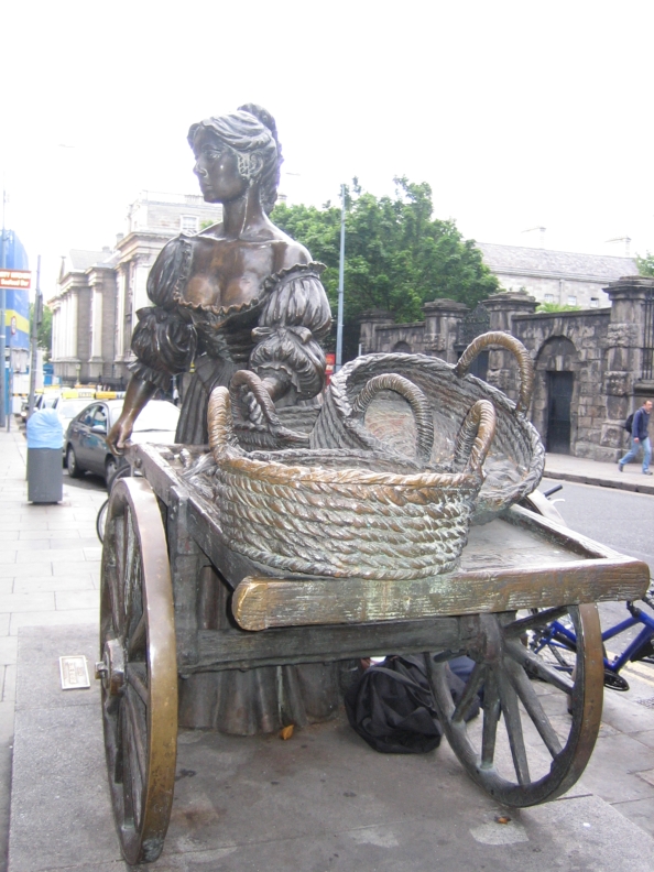 19. Molly Malone, Dublin
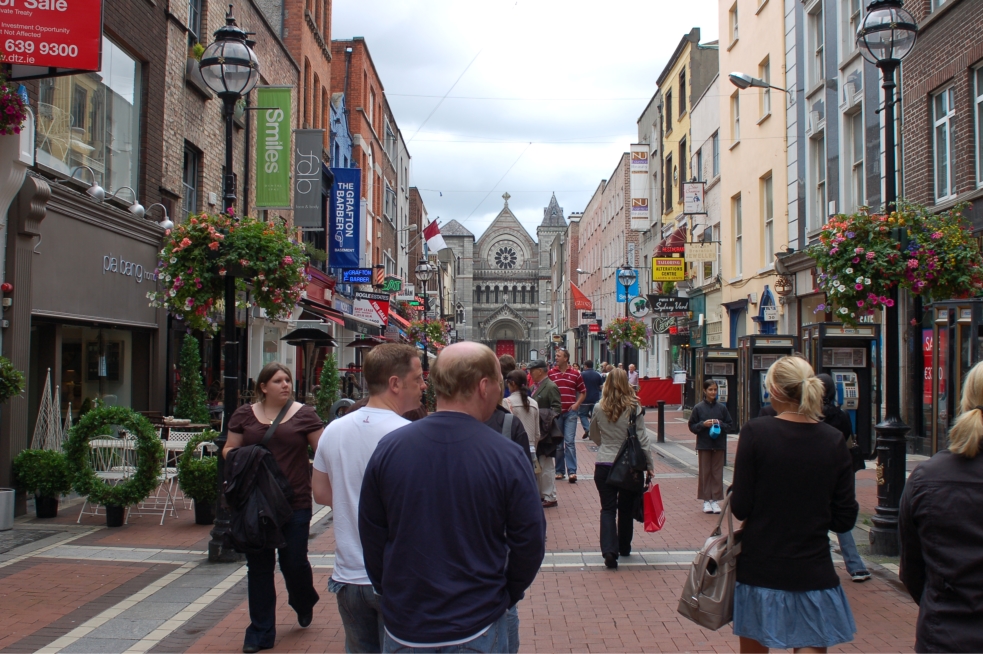 20. Shopping area in Dublin
 Map of Ireland