2012 - Norway
Date of tour: May-June 2012 (4 weeks)
Distance travelled: approx. 5000km
Total cost of tour (for two people): €3700
Map showing points of interest
Getting there and around
Prices are for two people and two motorbikes
Ferry Kiel-Oslo €190
Ferry Kristiansand-Hirtshals €88
Short ferry crossings within Norway approx. €14
Good motorbiking routes
Click on the photos on the right to enlarge them.
Many routes are toll-free for motorbikes, although there is a charge for the undersea tunnels in the area around Kristiansund. Petrol was €2 per litre in 2012.
We chose to go to Norway outside the high season (which is mid-June to mid-August) to avoid the crowds. The advantage of this was that we had some of the roads entirely to ourselves. The disadvantage was that not all the roads had been opened; the Trollstigen, for example, was still closed due to snow and ice.
Below are some of the best routes from our tour.
Central Norway
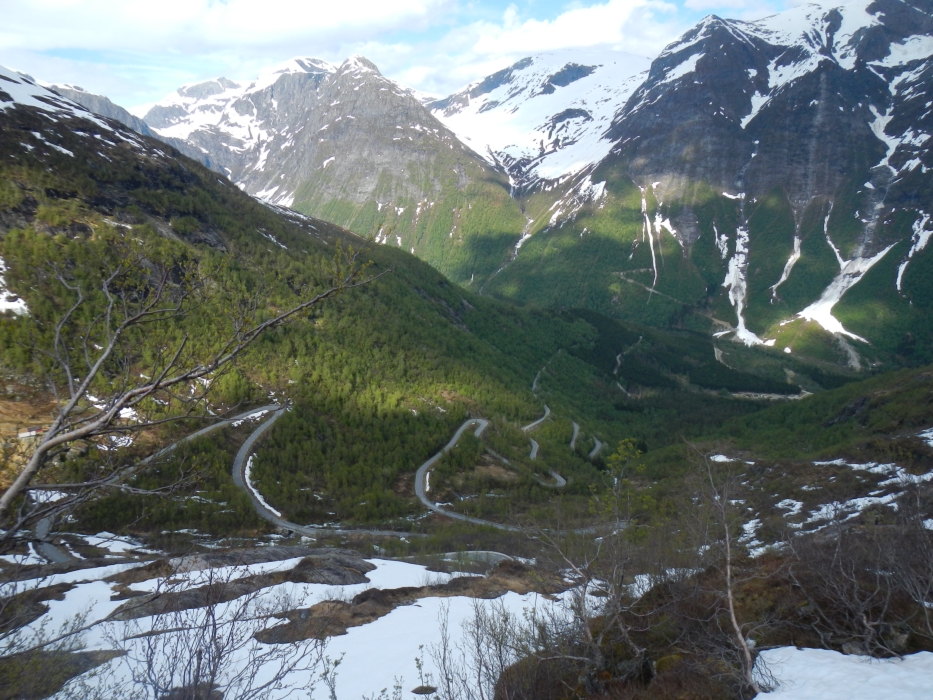
1. TOP TIP Sognefjellet Road (RV55) in the Jotunheimen National Park. This was by far one of the best motorbiking roads on the tour. From our base in Lom, we took the RV55 to Sogndal, with a diversion up to the Jostedalsbreen glacier (RV604) and circled back via the scenic toll-road (bikes have to pay too, but it's worth it) between Øvre Ardal and Turtagrø. This road, which climbs to an altitude of 1400m from sea level, had only just been cleared, leaving high banks of snow on each side (Photo 1). The RV604 takes you as far as the lake at the foot of the Jostedalsbreen glacier (Photo 2). The walk around the lake to the glacier takes approximately one hour.
2. Fagernes - Randsverk (RV51). This was our first contact with Norway's motorbiking roads, since it was the route from Oslo to our next stop, Lom. On the way we encountered a thundering waterfall (Photo 3) and a thawing lake (Photo 4).
The Western Fjords
3. Trollstigen. Although we didn't manage to do this route on this tour (it was still closed at the beginning of June due to snow and ice), it's a well-known motorbike route with 11 hairpin bends, a 1:12 gradient and dramatic scenery.
4. Romsdalen Valley (E316). This route passes the Trollveggen (Troll Wall), the highest vertical rock face in Europe (Photo 5).
5. TOP TIP Atlantic Ocean Road (RV64) - just for the novelty factor. This 8km road includes eight bridges and connects several small islands between Kristiansund and Molde. Some of the bridges are a feat of engineering (Photo 6). We experienced the road on a calm and sunny day; it would be interesting to ride it in a storm!
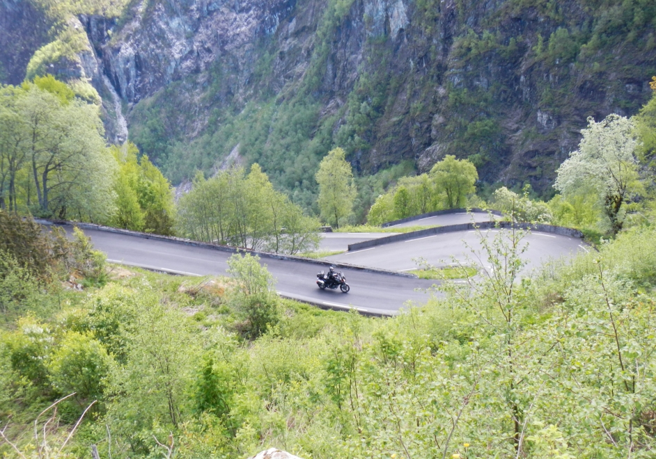
6. Ålesund - Balestrand (E39). This 300km route involves a number of short ferry crossings and a variety of scenery, through fjords, mountain passes and small towns. There are some lovely hairpin bends on the RV13 near the Nystølsvatnet lake just north of Balestrand (Photo 7).
7. TOP TIP “The Snow Road” is a winding 47km route from sea level up over the Aurdal mountain from Aurland to Laerdal. (Under the snow road, the world’s longest road tunnel at 24km connects the two resorts.) The 600m-high Stegastein viewpoint offers breathtaking views over the Aurlandsfjord (Photo 8).
The Southwestern Fjords
8. Hardangervidda National Park (RV7). The route from Eidfjord to the Vøringfossen waterfalls climbs steeply within the mountain, i.e. you enter the mountain at the bottom, then ride round and round in a corkscrew, then exit the mountain at the top. After 20km you reach the 182m-high Vøringfoss waterfall. Tip: Instead of stopping at the visitor viewpoints, drive a bit further up to the Fossli Hotel (parking is free for motorbikes) for a coffee and a better view of the waterfalls (Photo 9). Hardangerfjord is one of the most photographed fjords in Norway due to the Trolltunga (Troll's Tongue Rock), which juts out horizontally above Skjeggedal in Odda. It takes around five hours to hike to it. Better to stick to the scenic tourist route which follows the fjord.
9. Stalheimskleiva is a short stretch of road leading down from the village of Stalheim. With a 20% gradient, it is one of the steepest roads in Europe, with 13 hairpin bends and fantastic views of the narrow Nærøydalen valley. Unfortunately, due to the number of tour buses that use the road, it’s a one-way street: you can go down but you can’t go up (Photo 10).
10. TOP TIP Lysevegen. There’s a wonderful route which is reached from Stavanger by driving to Lauvvik and taking the ferry up the spectacular 42km-long Lysefjord, home to the much-photographed Preikestolen (Pulpit Rock). The ferry is the only way to see this fjord in its entirety as there are no roads which skirt it completely. At the head of the fjord is a small tourist resort called Lysebotn but the highlight of the tour is the Lysevegen, a 29km route with 27 hairpin bends going from sea level to over 900m (Photo 11).
Accommodation
Some campsites are open all year round, others only open in June so check ahead. When nights are cold, the huts (chalets) are a good affordable option.
The costs of one night's camping for 2 people, 2 bikes and a tent ranged from €16 at Kristiansund (not a very nice campsite) to €29 at Rysstad (a 5-star campsite - Photo 12).
The costs of one night's accommodation in a hut (chalet) for two people ranged from €56 at Eidfjord (beautiful views of the fjord and mountains from this campsite) to €93 at Flåm (a 5-star campsite with heated floors in the showers - Photo 13).
Hotel rooms were upwards of €120.
Food
There is no shortage of meat and seafood in Norway, however, food prices are high, even in supermarkets, compared to other European countries. In restaurants, a burger and fries costs around €20, a pizza €25 and a steak or fish meal €40. In bars, a cola is €5 and a beer or glass of wine €10.
Worth a visit
1. In Oslo, the Bygdøy Peninsula is definitely worth a visit. As well as being a peaceful, green oasis right next to the capital, this area is home to:
the Fram Museum, where you can climb aboard the ship which enabled Roald Amundsen to become the first person to reach the South Pole (Photo 14).
the Viking Ship Museum with exhibits of well-preserved vessels which carried the Vikings overseas (Photo 15).
the Kon-Tiki Museum, which chronicles the extraordinary journey made by Thor Heyerdahl in 1947 when he crossed the South Pacific on a balsa-wood raft to prove that Polynesia was populated by South Americans. In 2012 an excellent Norwegian film was made about the expedition.
2. Ålesund is a very attractive Art Nouveau town on the coast of the Western Fjords (Photo 16).
3. The pretty little village of Balestrand (pop. 1350 – Photo 17), situated on Norway’s largest fjord, the Sognefjord, was the favourite holiday destination of the German Kaiser Wilhelm II, who visited the town every summer for 25 years, until the outbreak of the First World War. The Sognefjord aquarium reveals what life forms can be found in the distant reaches of this 1300m-deep fjord.
4. In Hanseatic times, Bergen was Norway’s largest city, attracting immigrants from many northern European countries. The result in modern times is a colourful mixture, both of ancestry and of waterfront buildings (Photo 18). The Hanseatic Museum on the Bryggen (wharf) is particularly interesting.
5. Approximately 200km south of Bergen, Stavanger is a similar-looking town but, at half the size, is much quieter. The narrow cobblestone streets flanked by whitewashed houses in Gamle (Old) Stavanger make for a very pleasant walk (Photo 19).
6. Finally, as you ride around southern and central Norway, you won’t fail to notice the many elaborate wooden churches, known as stave churches, such as the Hopperstad Stave Church in Vik (Photo 20). Stave churches are heavily restored versions of some of the oldest surviving wooden buildings in the world, going back to the Viking age. Hopperstad is thought to date from the year 1140.
Recommended reading: Lonely Planet Travel Guide to Norway (2011)
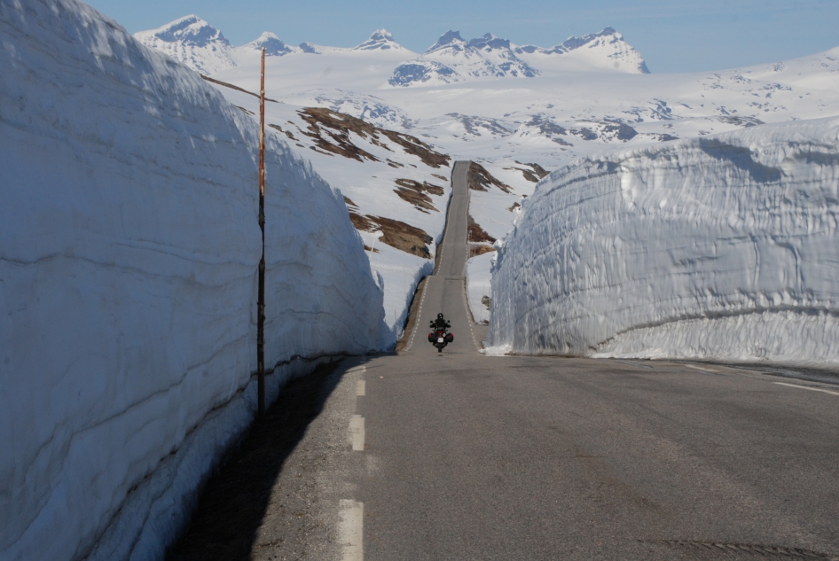 1. Banks of snow between Ovre Ardal and Turtagro
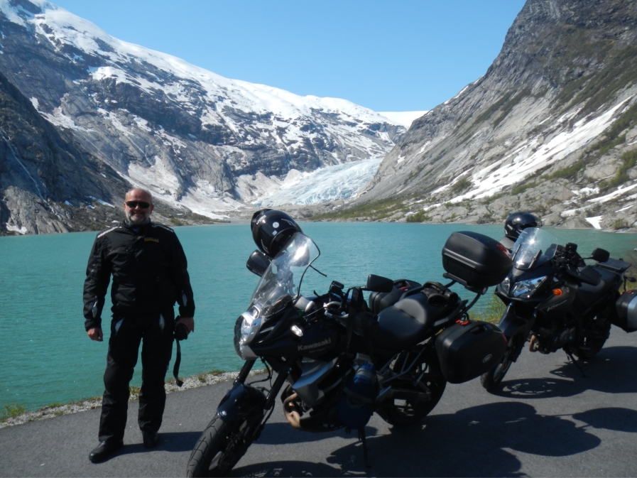 2. Jostedalsbreen glacier
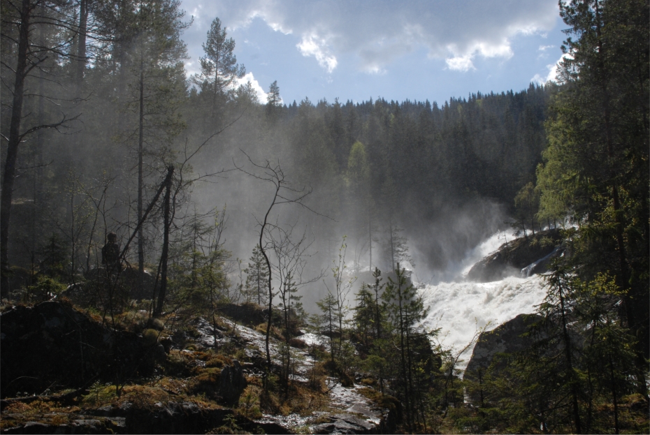 3. Waterfall next to the RV51
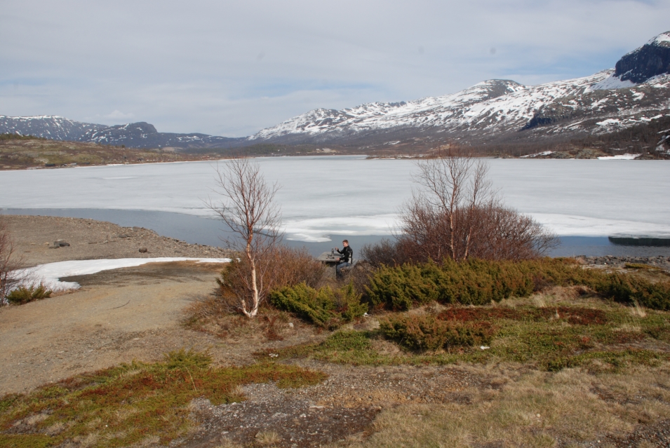 4. Thawing lake next to the RV51
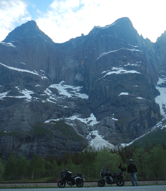 5. Trollveggen in the Romsdalen Valley
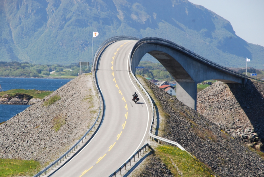 6. Atlantic Ocean Road (RV64)
 7. Hairpin bends on the way to Balestrand
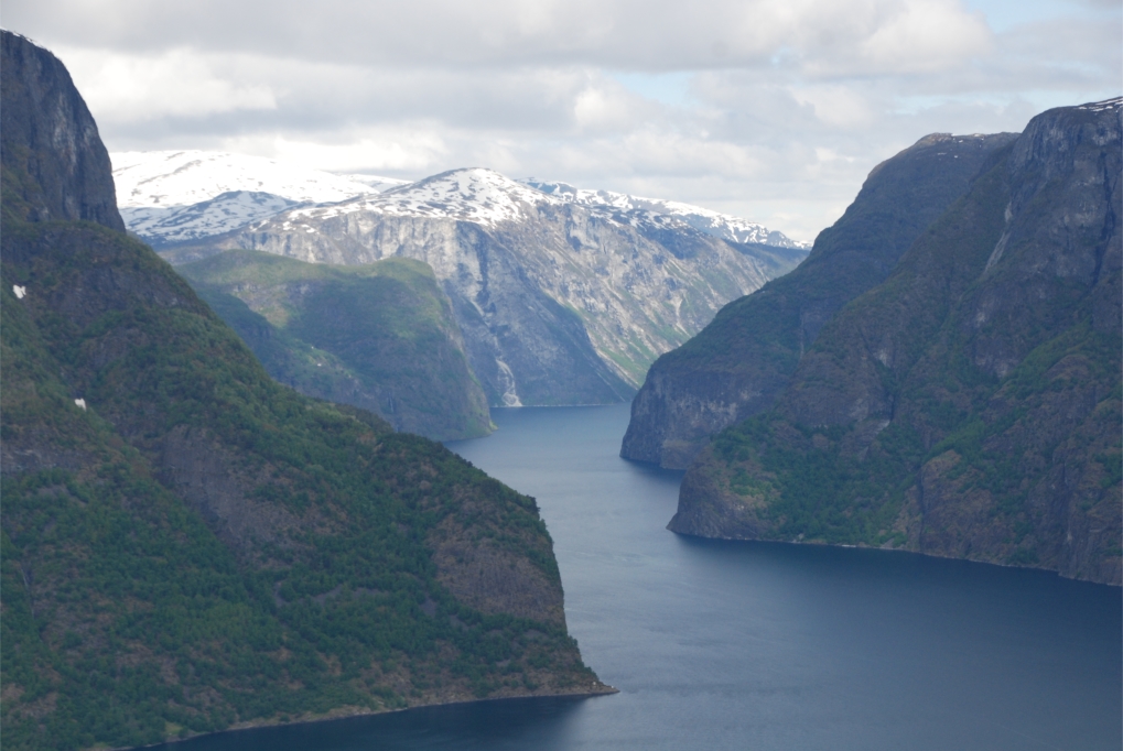 8. View of the Aurlandsfjord from the Snow Road
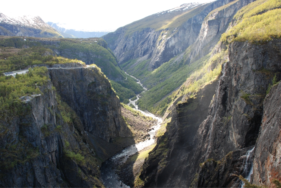 9. View over the Voringfossen from the Fossli Hotel
 10. Hairpin bends on the Stahlheimskleiva
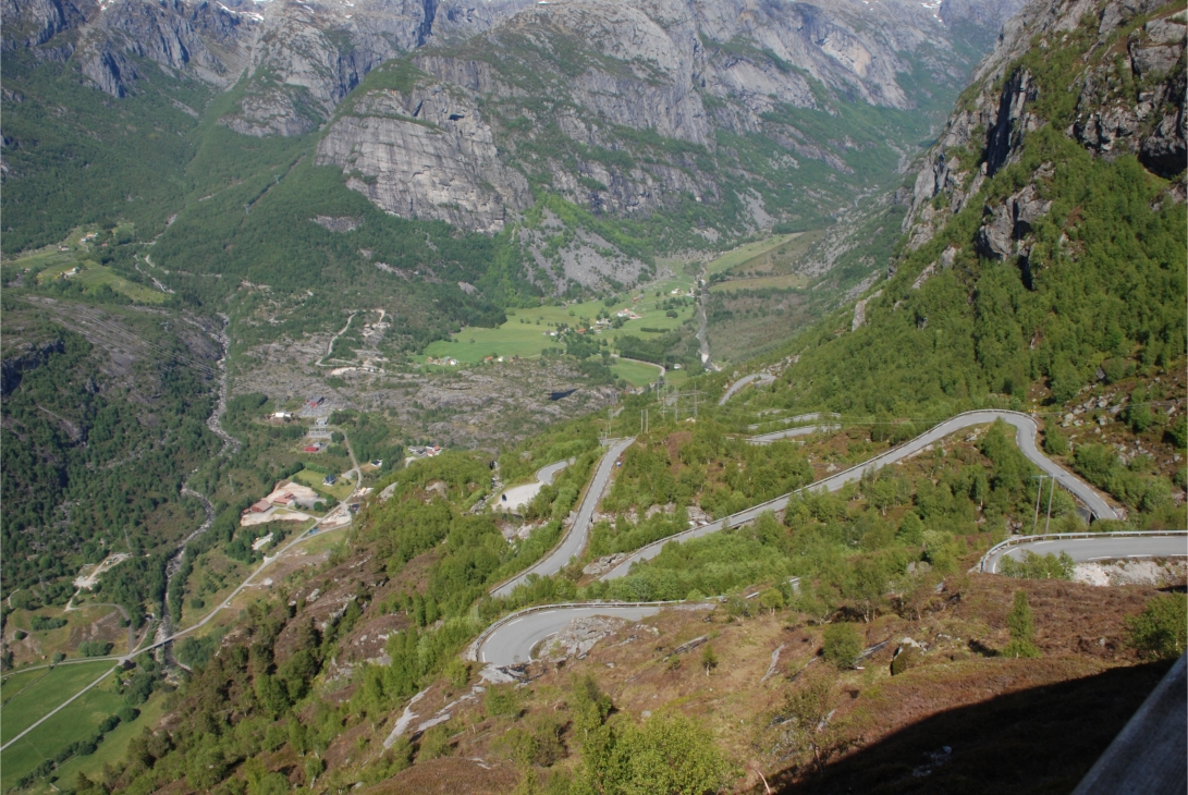 11. Lysevegen
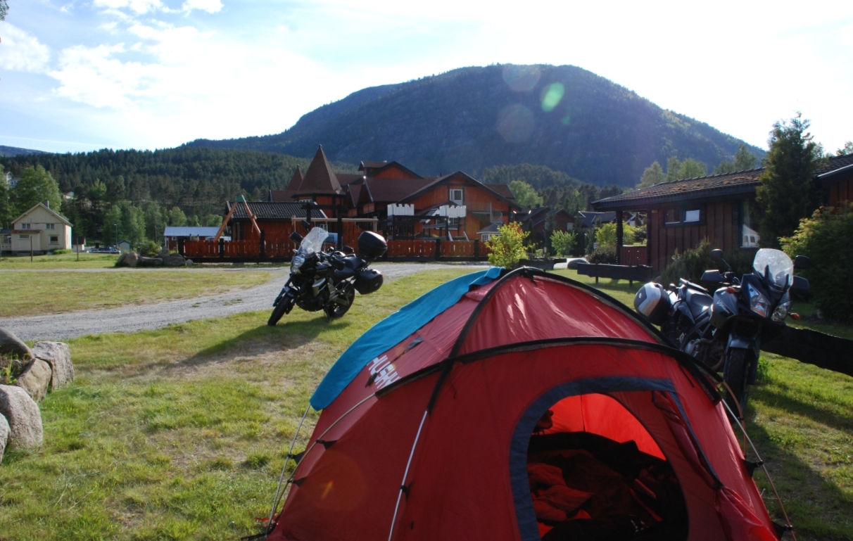 12. Solvgarden campsite in Rysstad
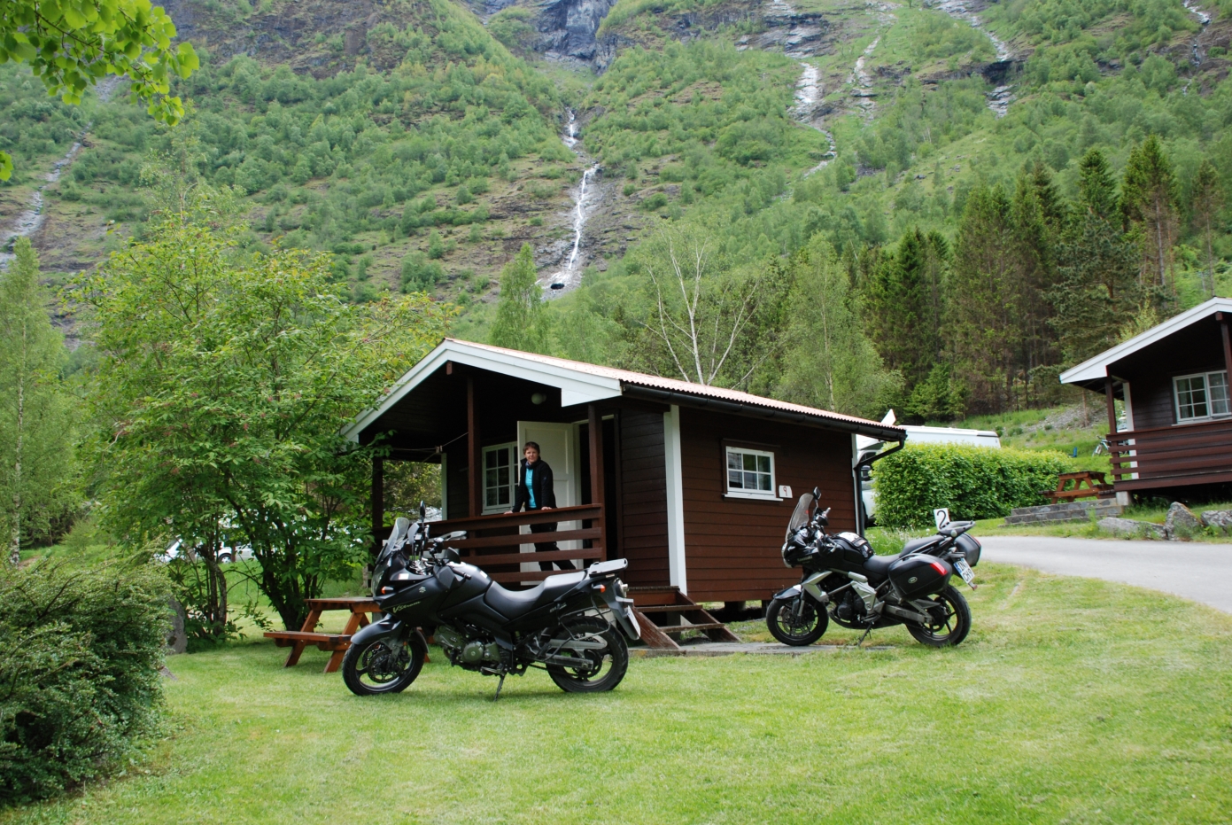 13. Campsite in Flam
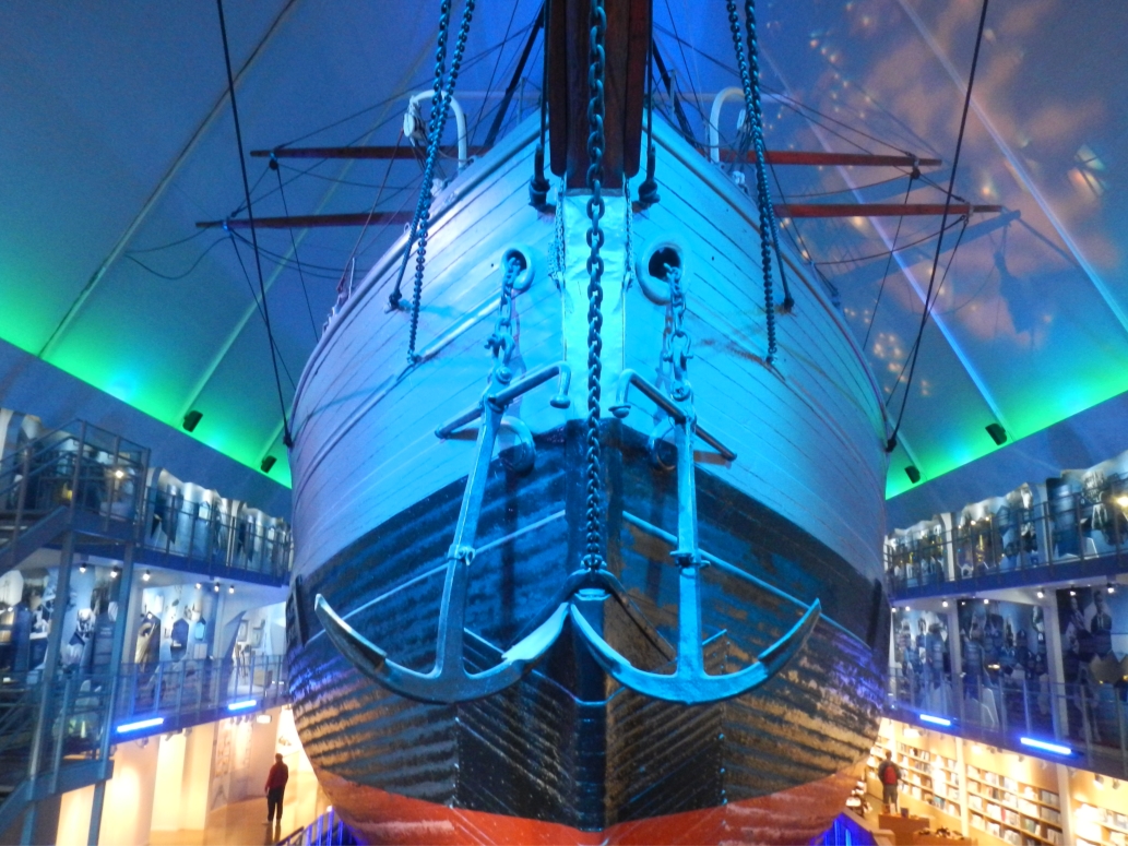 14. Fram ship
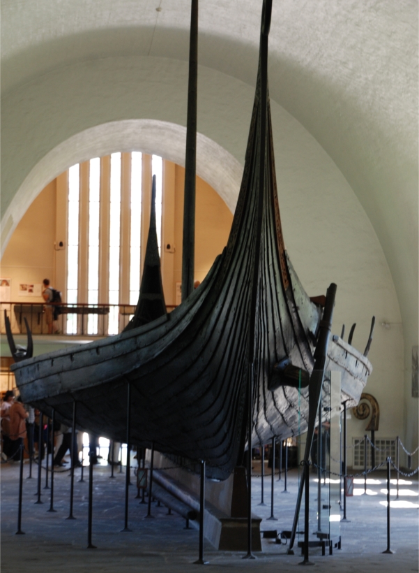 15. Viking ship
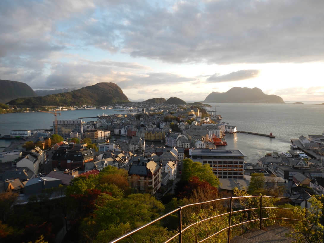 16. Alesund
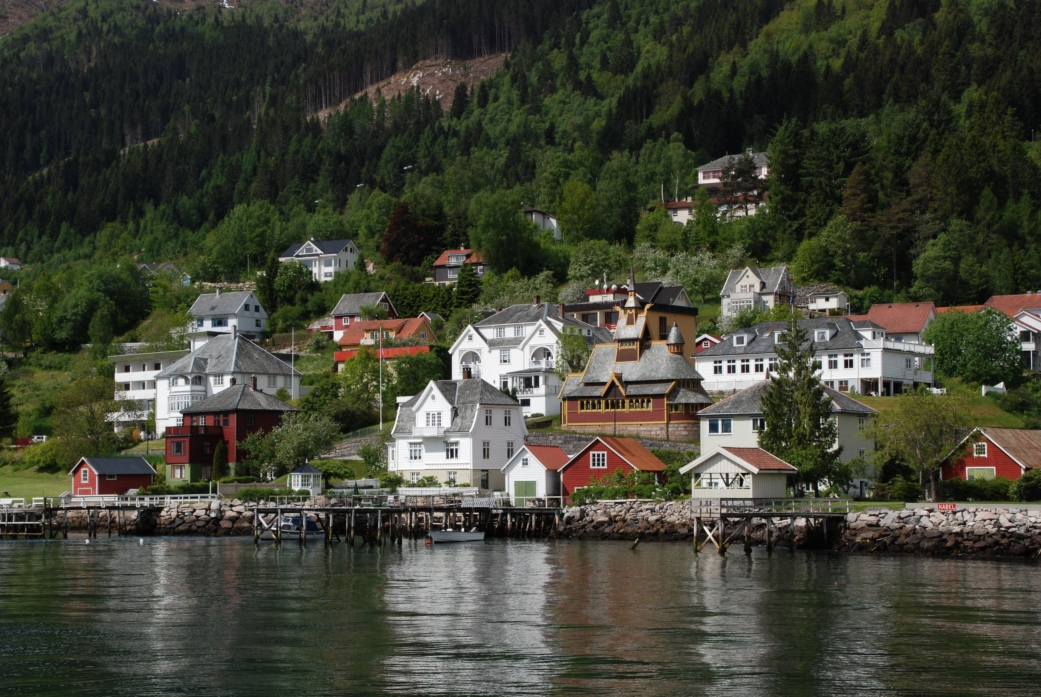 17. Balestrand
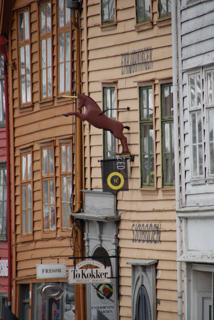 18. Waterfront buildings in Bergen
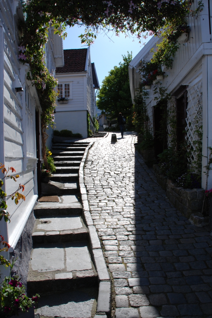 19. Stavanger
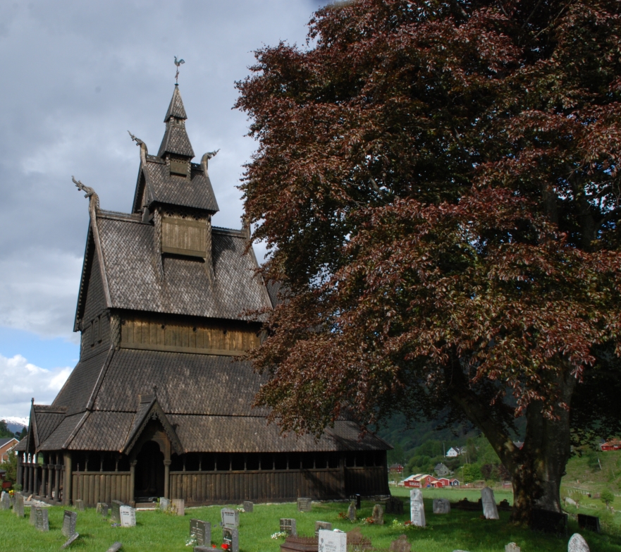 20. Hopperstad stave church
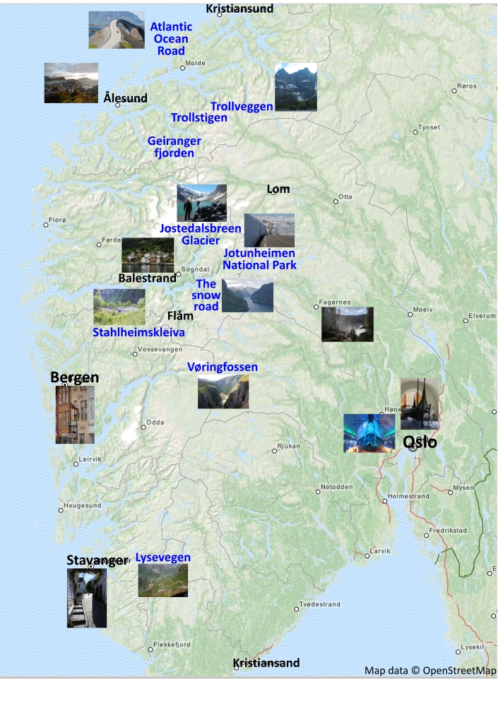 Map with points of interest